Scanned. Modeled. Delivered.
Explore how we've helped clients across industries capture reality with precision 3D scanning technology.
Architecture Projects
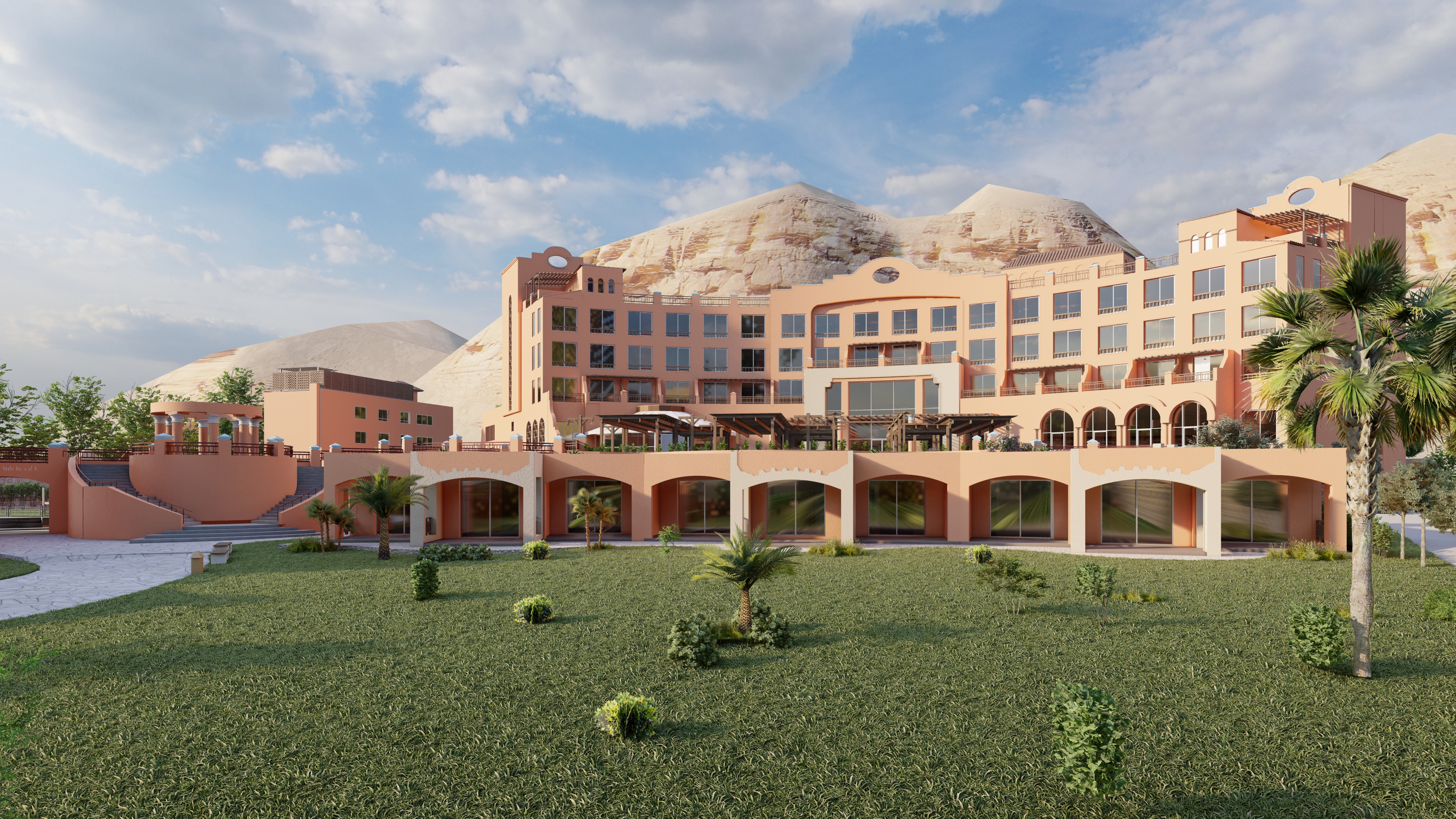
Movenpick
Challenge
Scanning vast, high-traffic resort areas with traditional tripods is slow and disruptive to guests, while long corridors and open landscapes often cause "SLAM drift," leading to distorted or misaligned 3D data.
Solution
Using Mobile Handheld Scanning, we capture the entire resort at walking speed during low-traffic hours. We eliminate drift by integrating "Closed-Loop" trajectories and physical survey targets to ensure absolute global accuracy.
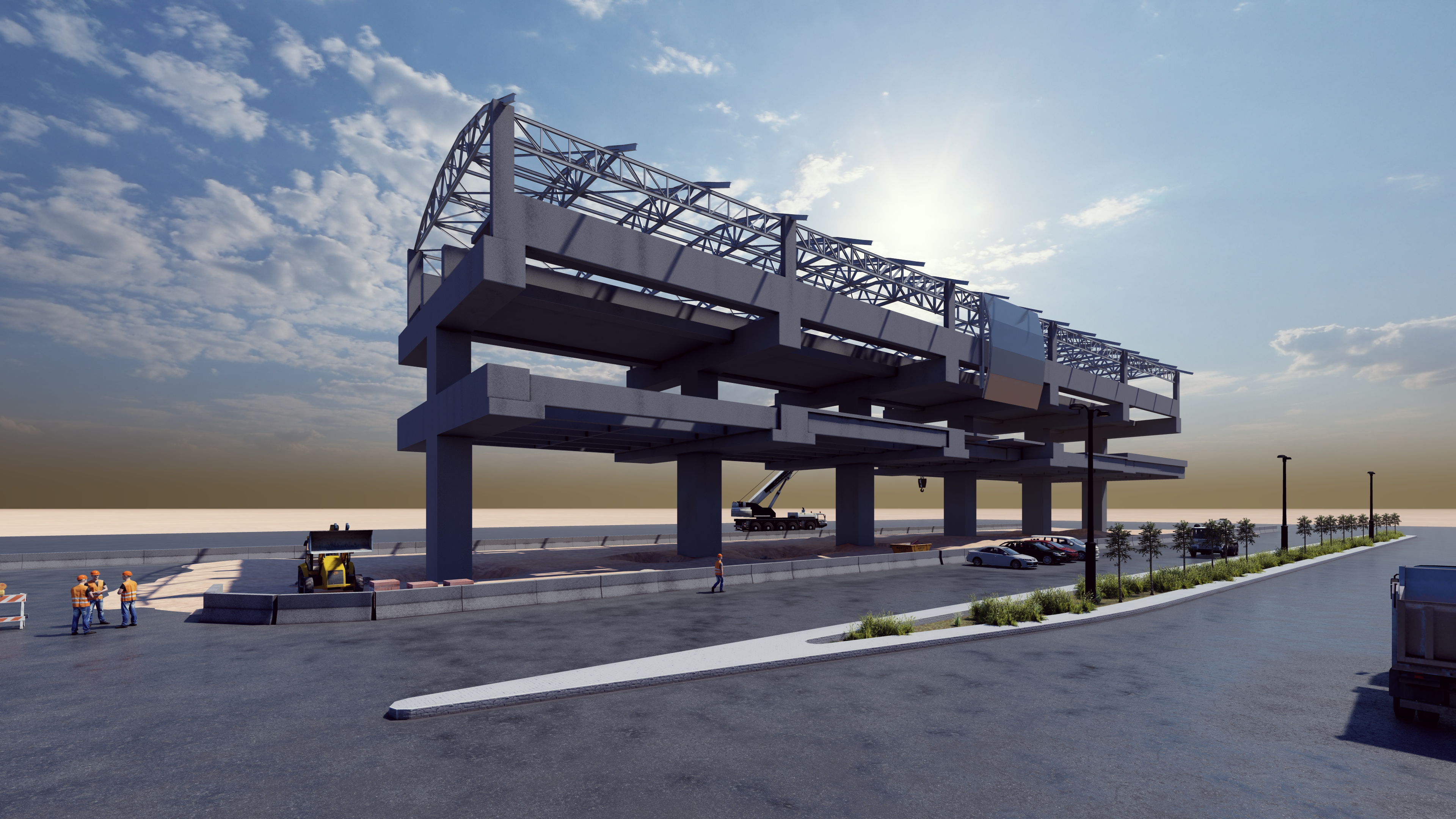
Monorail Station 22
Challenge
Scanning massive, elevated transit stations with complex steel structures and a lot of high scaffolding creates "blind spots" and "SLAM drift", where the long, repetitive geometry of the station leads to misaligned 3D data and cumulative accuracy errors.
Solution
For the site we used Mobile Handheld Scanning to capture all levels at walking speed. To ensure structural precision, we lock the mobile data to a GCP network and for the office we manually deleted the scaffolding to ensure accurate modeling and guaranteeing millimeter accuracy.
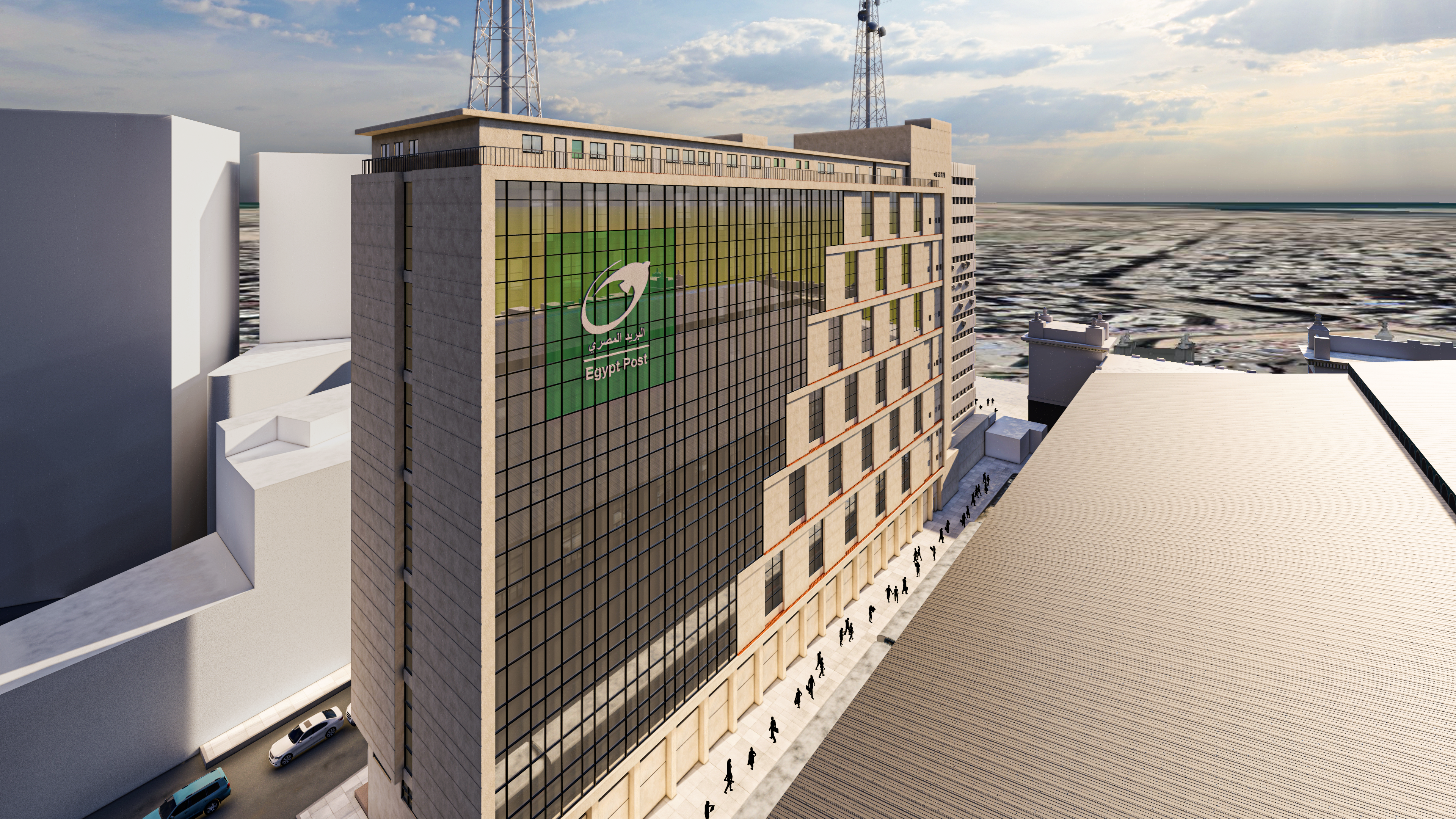
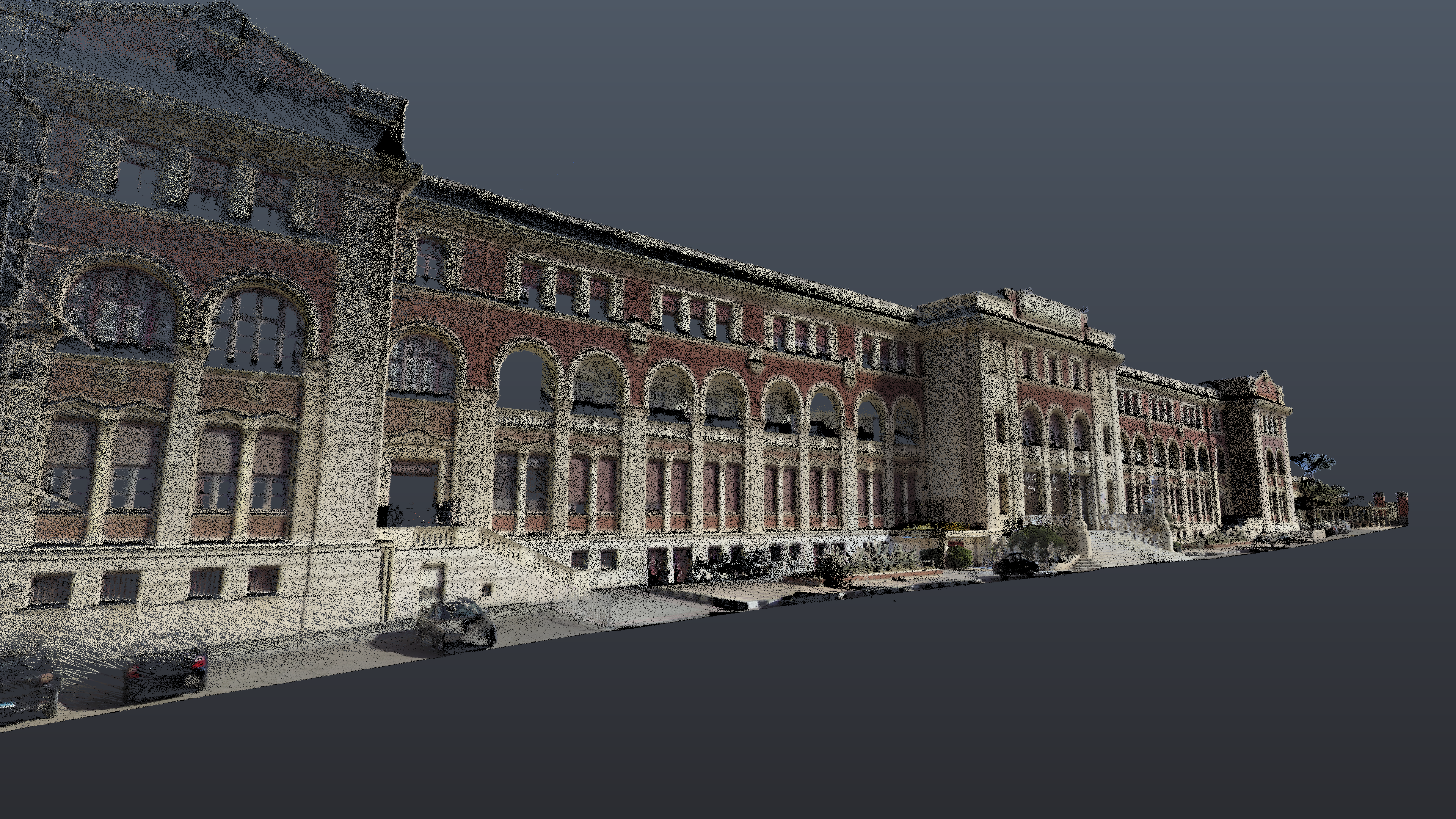
Alexandria Main Post Office
Challenge
Extremely narrow alleys and high-density surroundings prevent capturing the full facade from street level. These tight "canyons" create steep scanning angles and leave the roof and upper architectural details in "shadow."
Solution
We utilize Handheld Mobile Scanning for the perimeter alleys, combined with vantage points from surrounding roofs. This dual-elevation approach eliminates "blind spots" and ensures a complete, high-resolution 3D model of the building's entire exterior.
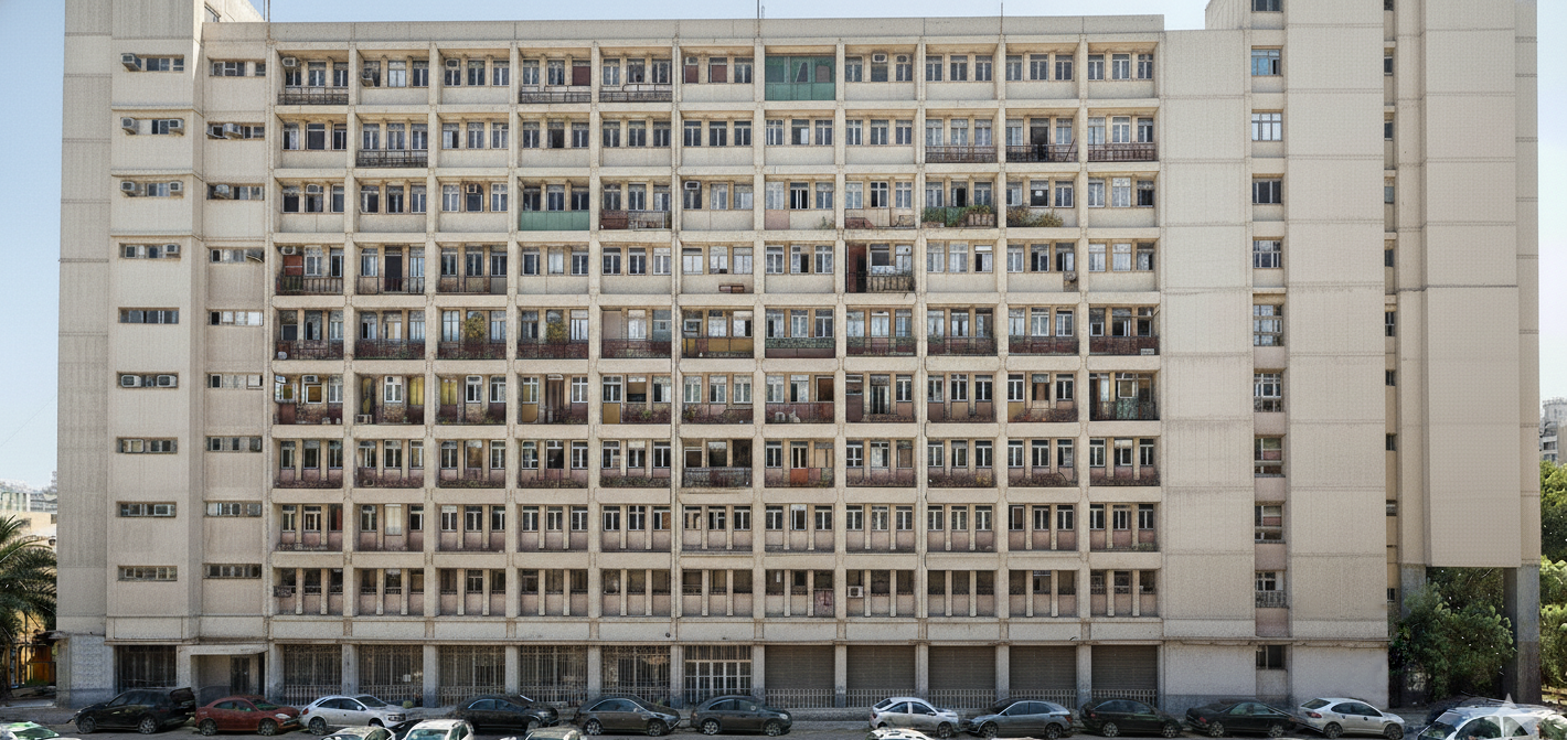
Ministry of Finance
Challenge
The immense scale and repetitive, uniform corridors of modern government buildings often cause "SLAM Drift," where the handheld scanner loses its precise orientation, leading to distorted 3D maps and cumulative spatial errors over long distances.
Solution
We implement a "Loop Closure" Strategy with our handheld scanner. By frequently returning to known starting positions and overlapping our walking paths, the SLAM algorithm automatically corrects and locks the geometry, ensuring a consistent and accurate 3D Pointcloud.
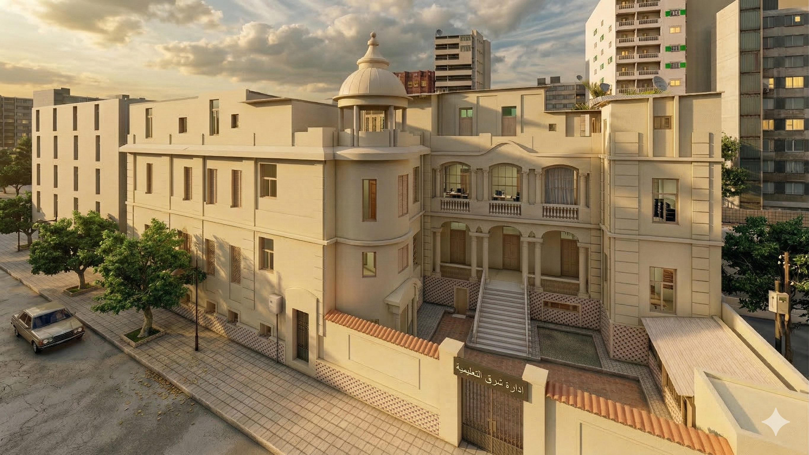
East Educational Building
Challenge
Educational buildings feature numerous identical and typical offices, long corridors, and multiple stairwells. This "Geometric Symmetry" often confuses handheld scanners, causing the SLAM algorithm to "slip" or misalign the 3D data between different floor levels.
Solution
We utilize Visual and Physical Targets placed at key transition points and stairwells. By scanning in a "closed-loop" path from floor to floor, the handheld scanner maintains its orientation, ensuring perfect vertical alignment and spatial accuracy.
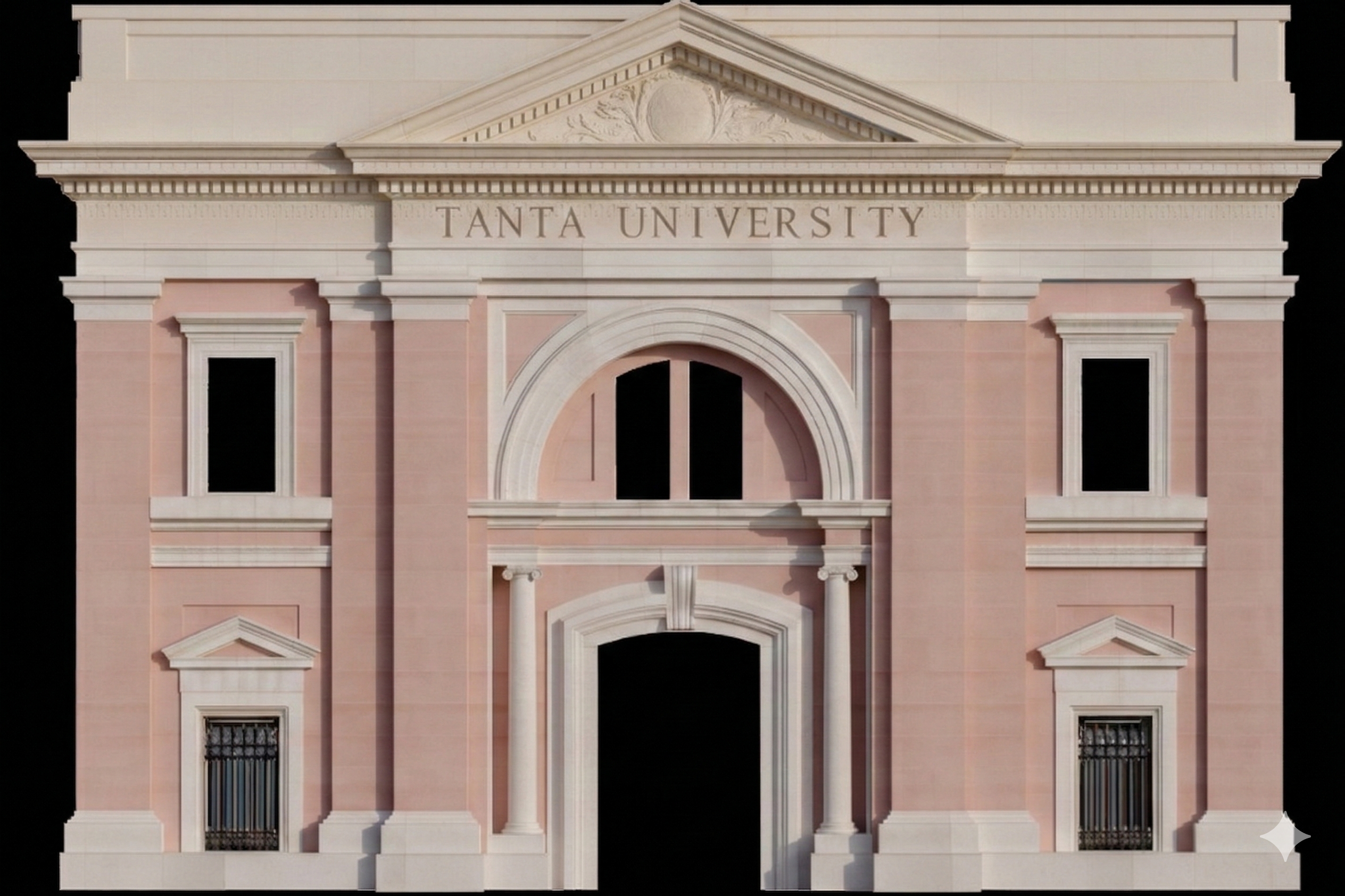
Tanta University Facade
Challenge
The intricate Roman-style decorations, deep reliefs, and high-arched cornices create complex "geometric shadows," where a standard scan from the ground misses the fine details hidden within the deep stone carvings and ornate textures.
Solution
We utilize High-Density Terrestrial Scanning at close and far proximity, scanning every pillar and decorative element. This multi-angle Stations ensures the scan algorithm captures every Roman detail, producing a complete, high-definition 3D Pointcloud.
Heritage Projects
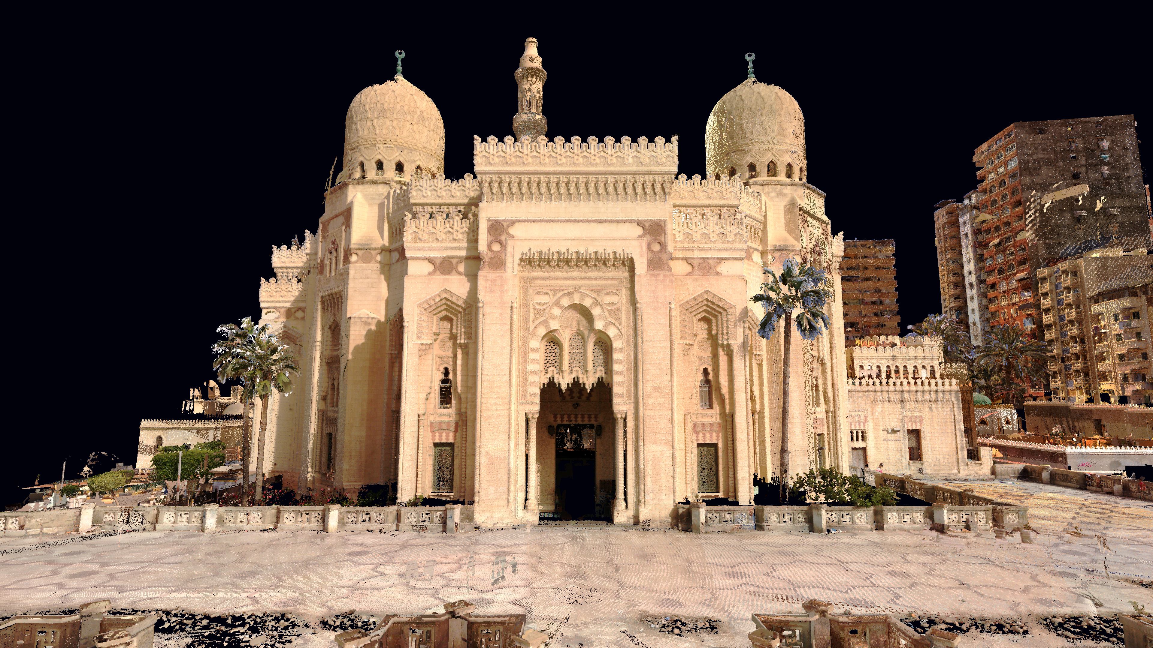
El Morssi Abo El Abbas Mosque
Challenge
Morsi Abl Elabbas mosque domes and walls covered with detailed patterns. Traditional measuring tapes and standard images cannot document them accurately.
Solution
we used advanced laser scanners that act like a digital eye, captures millions of points per second, ensuring high quality pointcloud that shows every ornament and pieces that needs to be repaired.
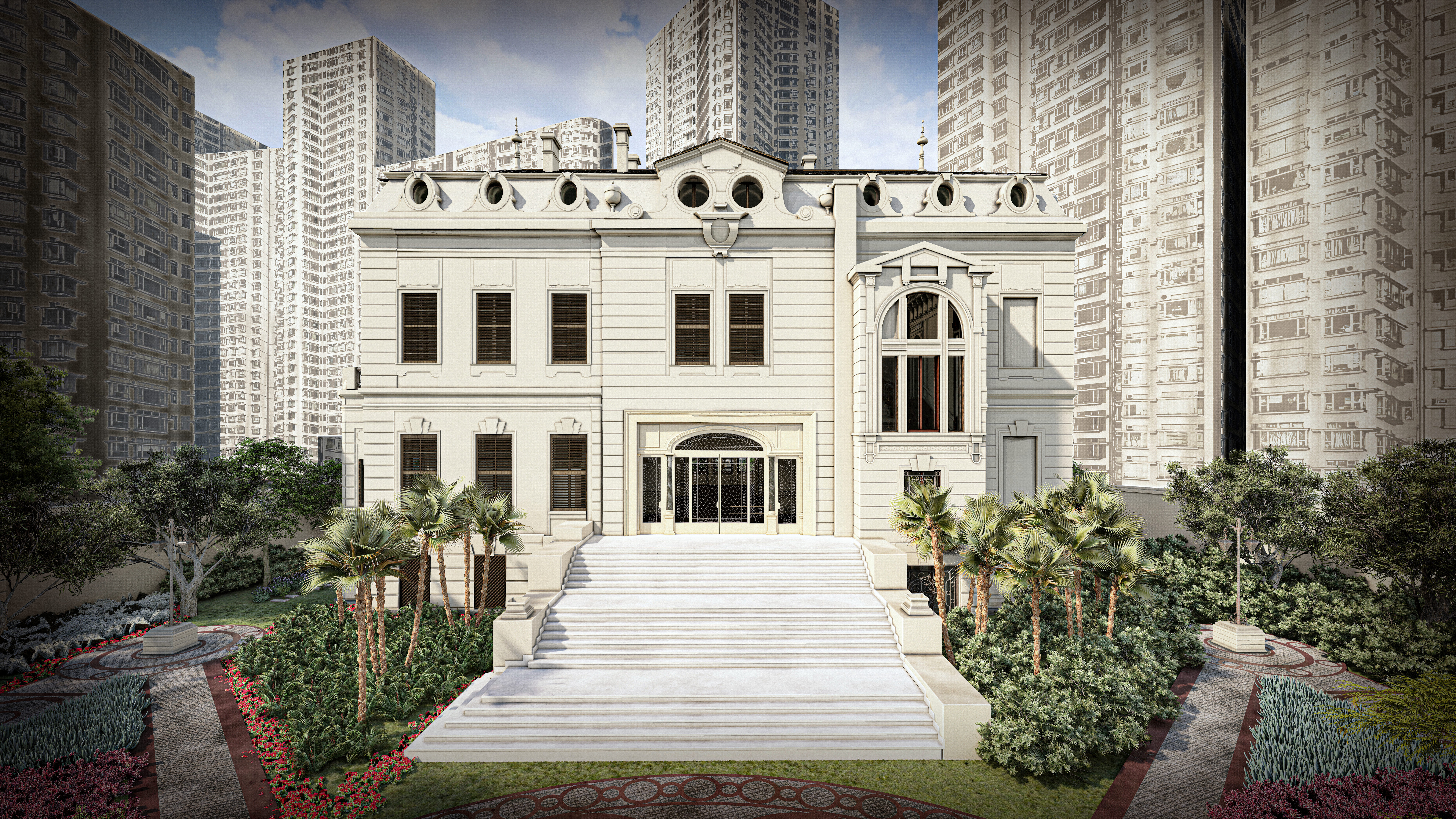
Kingdom of Saudi Arabia Consulate
Challenge
An Old heritage building with delicate structure and hard accessibility, also, filled with carvings and ornaments, required conducting surveying for documention and restoration.
Solution
Using different types of laser scanners to map every inch without physically touching a single ancient stone, capturing the ornaments with high density to show cracks and ornaments to deliver a high quality 3D model and 2D drawings.
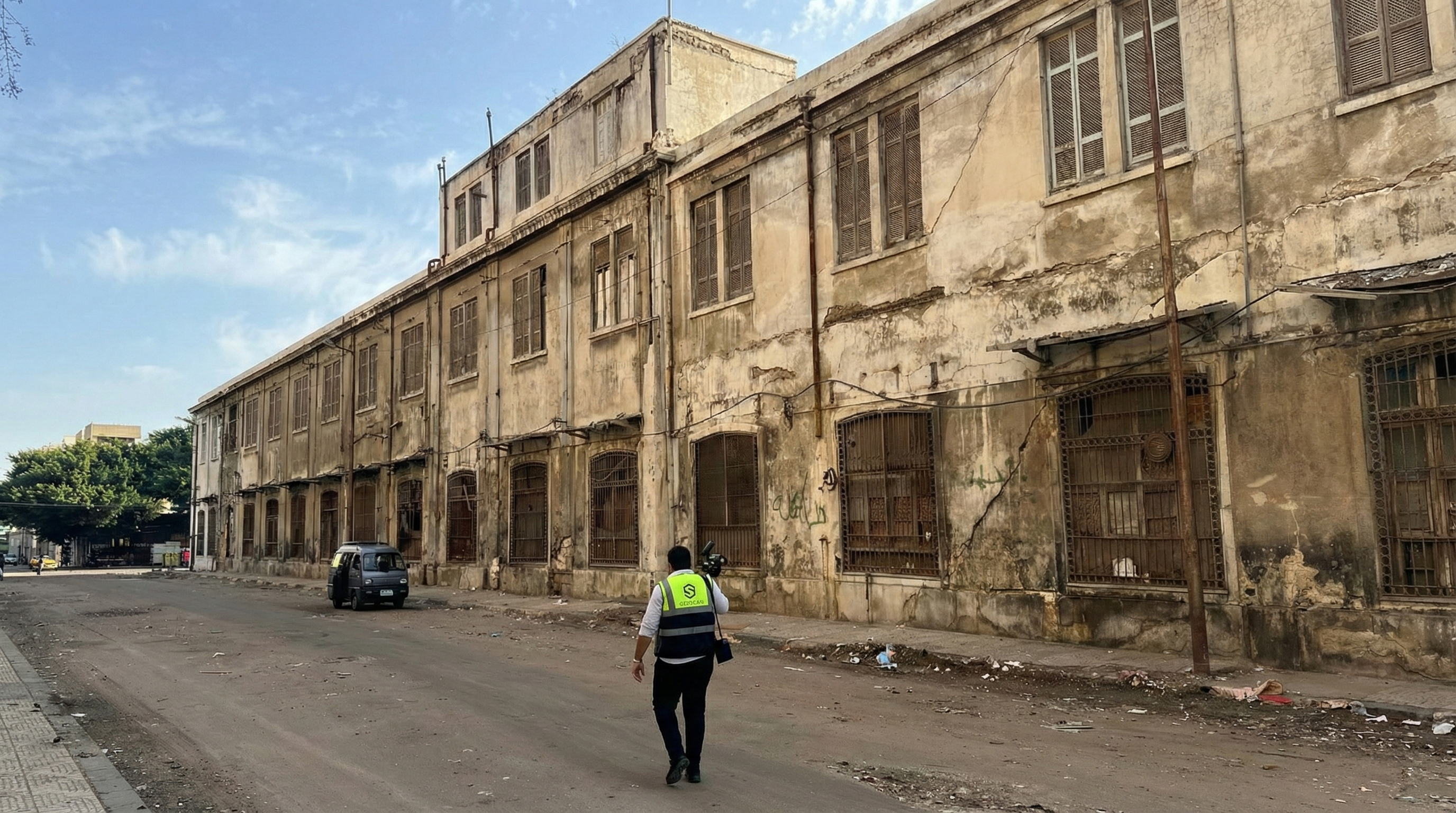
Cotton Bourse Building
Challenge
An ancient decaying building that had been neglected with delicate structure, capturing and turning it into clean 2D drawings that a construction team can use is a massive challenge.
Solution
Using different scanners to capture several areas with different accuracies and deliver 2D drawings for the building that provide enough details for making restoration and rehabilitation decisions.
Davies and Metropolitan Camp
Challenge
Two buildings build by the American delegation and by the polish delegation for decades, with a complex and irregular shape and floors required full surveying and documentation, A traditional method cannot fulfill this hard mission.
Solution
Using laser scanners to see through the complexity and capture each building in one unified pointcloud that allows us create a detailed 3D model and 2D drawings for all elements even the irregular ones and extract any other data needed for documentation.
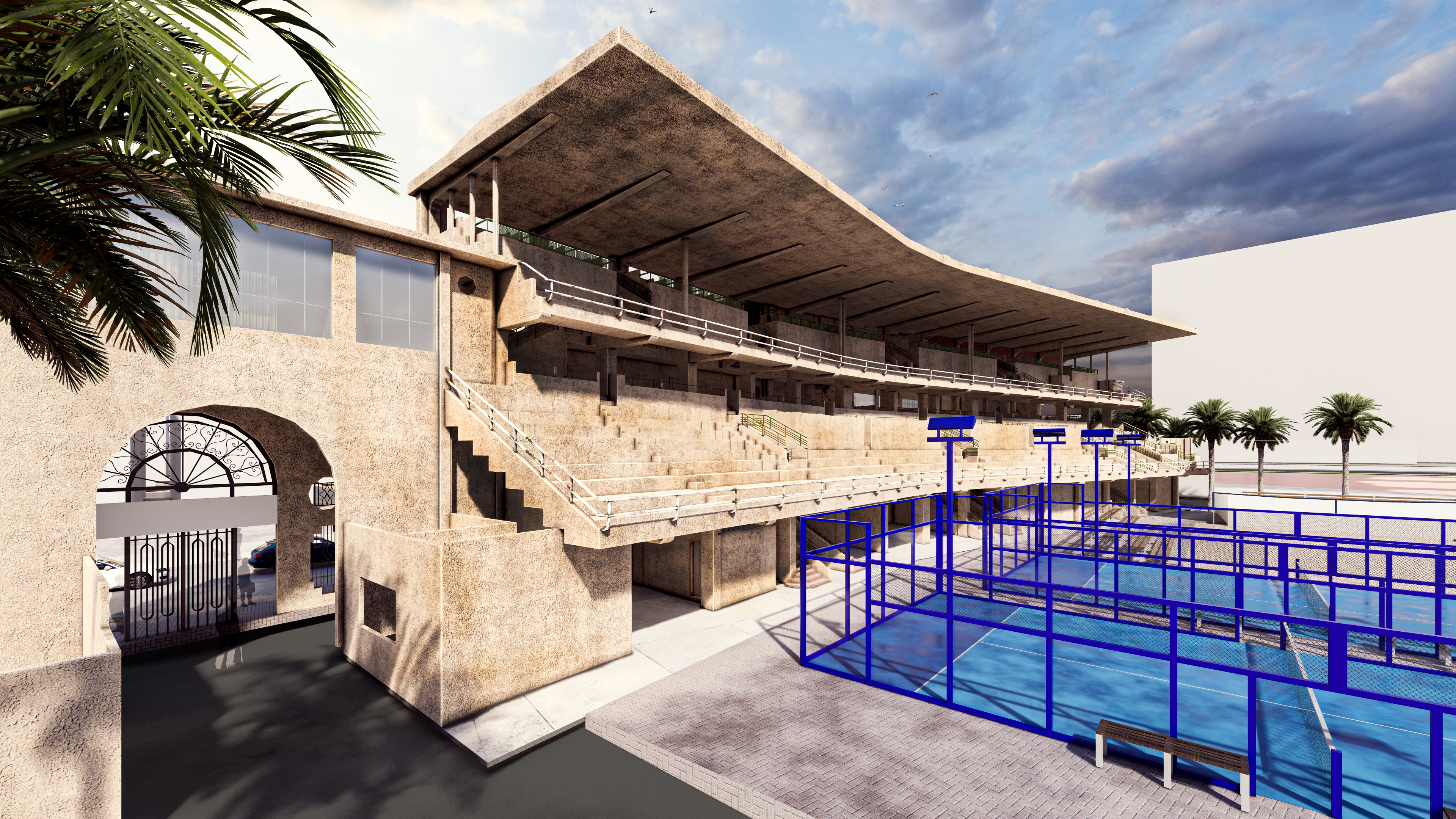
Horse Racing Grandstands at Sporting Club
Challenge
Sporting stadium in Alexandria, A stadium that wasn't just big; it was a complex maze with overlapping multilevels and many stairs, traditional method like measuring tapes or manual scanners were physically impossible to use.
Solution
We didn't just capture this complex 3D puzzle but also created a detailed 3D model. Using Mobile SLAM technology to scan through the building, mapping every detail and capturing all the different levels then using the generated pointcloud to create a 3D digital twin that can be navigated throw to understand the shape and form of this building.
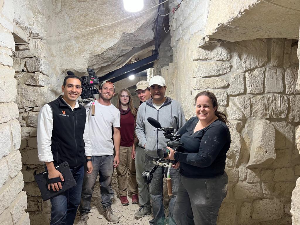
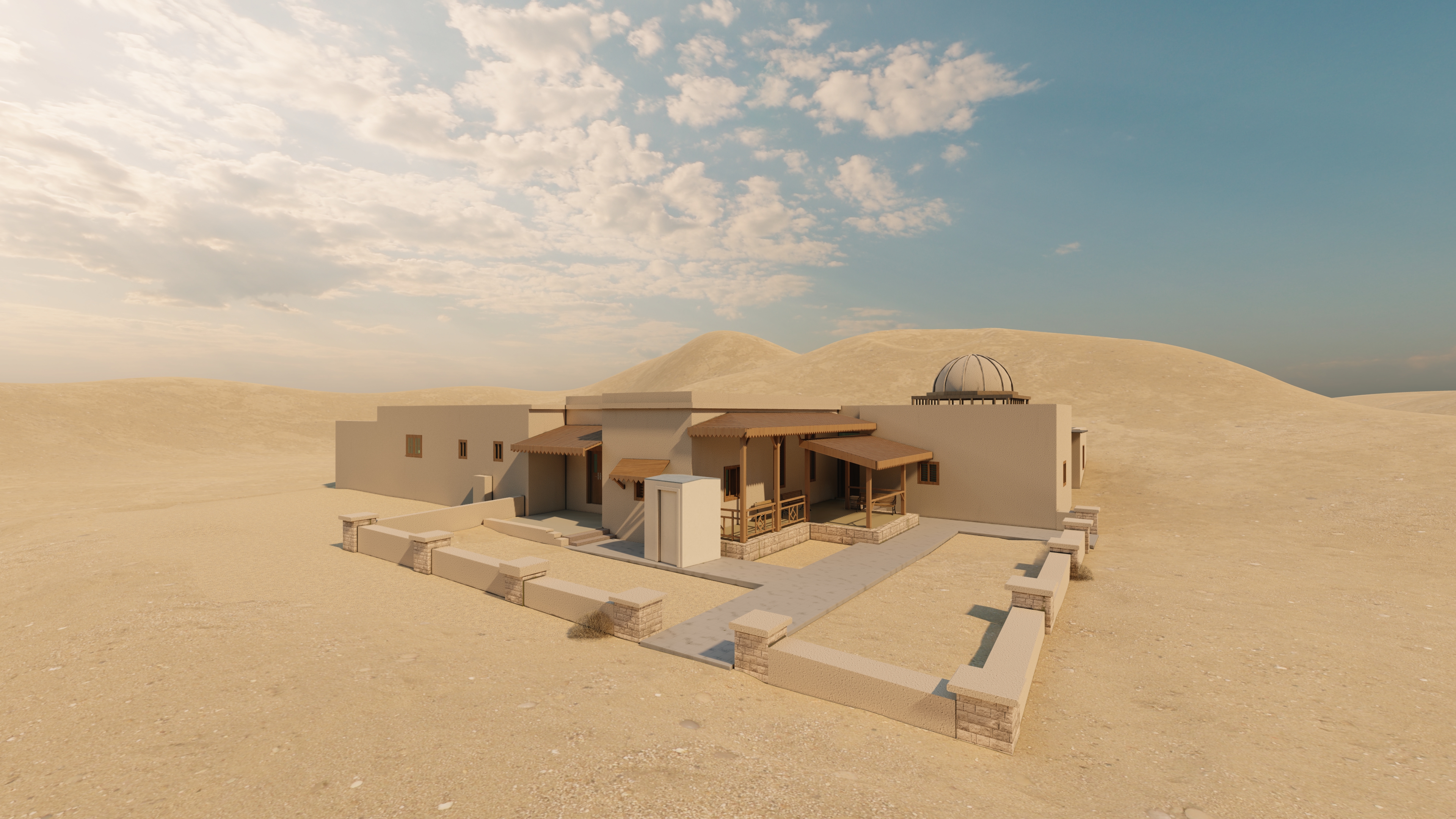
Sahuraa Pyramid
Challenge
The excavation is a delicate and fluid process ,ensuring the safety of the structure and the accuracy of the finds is needed, Also, the interior of the pyramid is pitch black and extremely cramped, neither the traditional ways or the heavy big equipment can help monitoring this hard process.
Solution
Using our lightweight, portable 3D Laser scanners that could be carried deep to the pyramid's heart capturing every stone and recording the "before and after" , providing the mission with a "perfect diary" of their progress and also a 3D model for the inside chambers of the pyramid.
College Saint Marc
Challenge
A massive Educational institution with busy sechdule ,and high students traffic, surveying for the entire campus and ,a church with highly detailed ornaments could only be ,conducted in one weekend before the bells rang.
Solution
with good planning everything is possible. with our high-speed ,scanning team, our smart strategy and good coordination, we used multiple ,Laser scanners to scan the whole campus in just one day, then delivered the 2D ,drawings in no time.
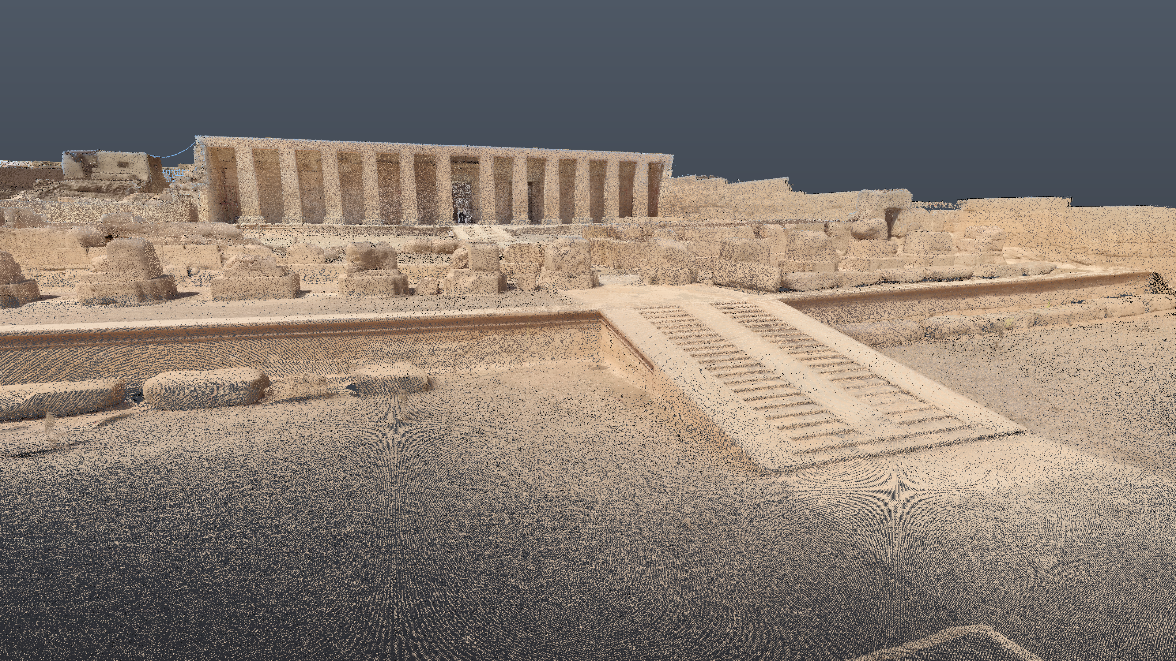
Abydos Temple of Seti I
Challenge
A building from the ancient civilization, with many chambers, dark corners, carvings on walls and complex form. Traditional methods and standard photography will take forever to document this ancient masterpiece.
Solution
we conducted the surveying with our high quality laser 3D scanners and SLAM technology to cover every inch and stone with at most speed and delivered a high density colorized pointcloud that enables exploring and documenting history with the easiest digital tools.
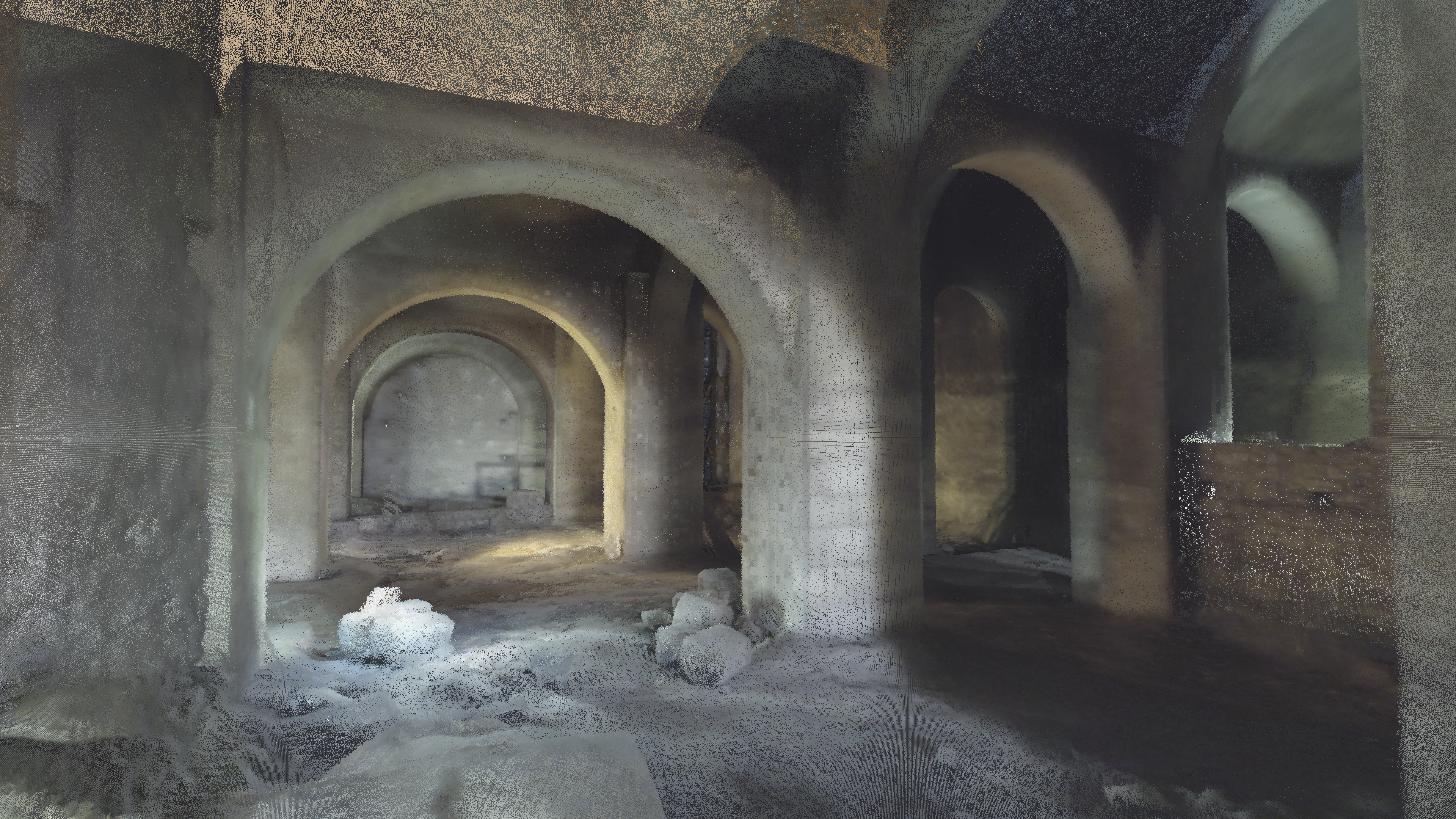
Mohammed Ali Castle
Challenge
A monumental architectural building that included thick, irregular stone walls, varying floor levels, arches and complex spaces like a maze that are difficult to align and document using the traditional surveying methods.
Solution
We used our scanners that capture the exact shape of the space and created a colorized pointcloud that shows all the details, stone textures and enables us walk through history and measure every inch with no issue.
Industrial Projects
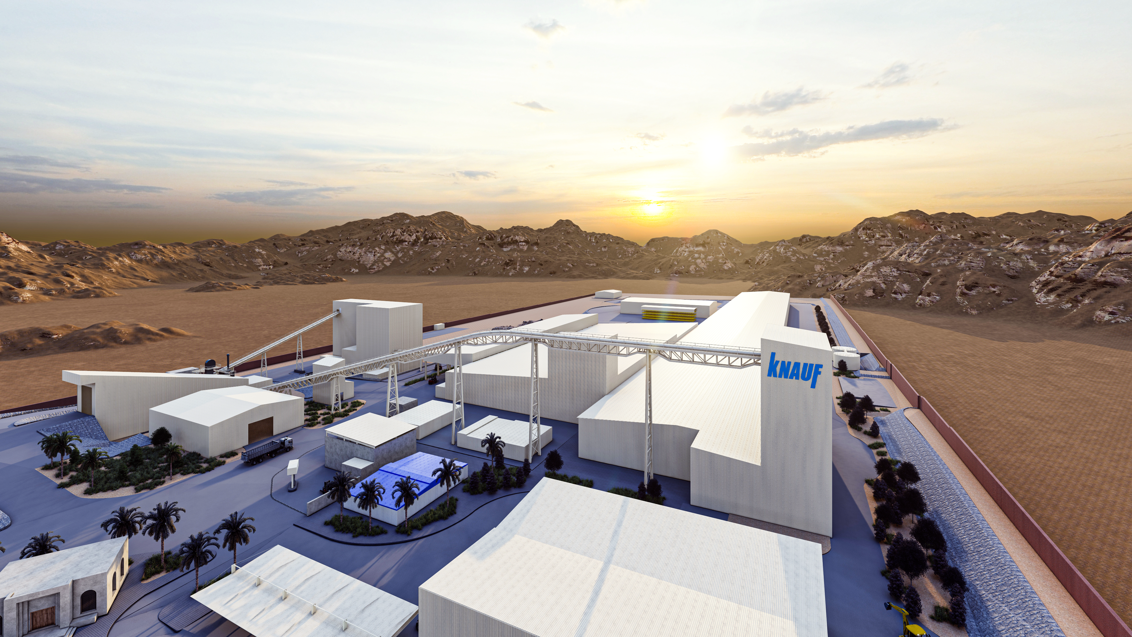
Knauf Gypsum Factory
Challenge
The factory's high-speed conveyor belts and constant vibration from gypsum processing machinery can cause "noise" in the point cloud, while airborne gypsum dust particles often reflect the laser, creating distorted data and blurry 3D surfaces.
Solution
We utilize Handheld Mobile Scanning with integrated "Dust-Filtering" algorithms. By moving strategically around vibrating equipment and using a "multi-Pass" walking strategy, we isolate the stable structural geometry from the environmental noise, ensuring a clean 3D model.
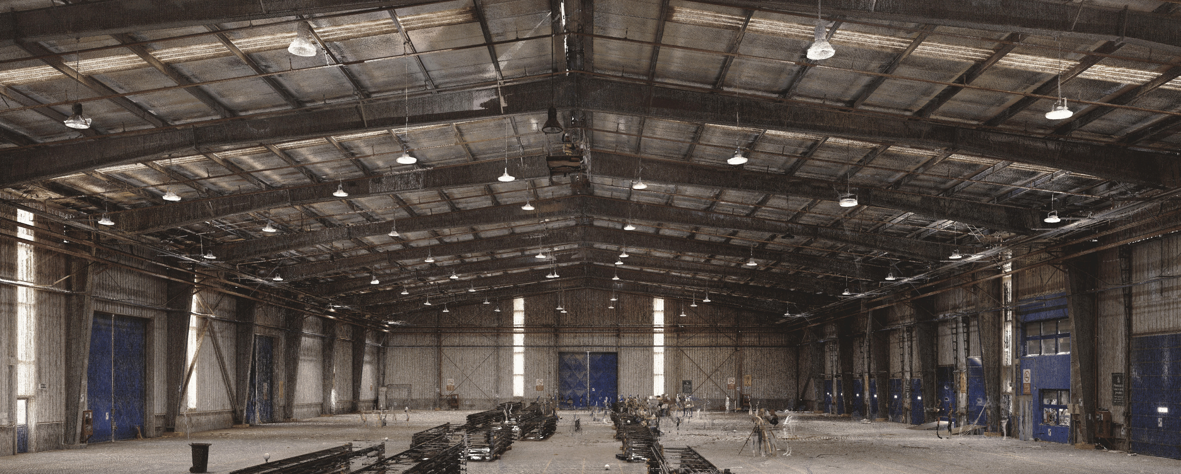
Steel Warehouse
Challenge
Achieving LOD 400 requires documenting every bolt, plate, and connection with millimeter precision. From a single floor position, the warehouse's dense steel rafters and high-level bracing create "occlusions" (blind spots), where the scanner cannot "see" the top or back of structural members.
Solution
We utilize High-Resolution Terrestrial Laser Scanning (TLS). By creating a dense web of overlapping scans, we eliminate all shadows and provide a high-fidelity point cloud and using of scissor lifts to get unreachable ceiling connections.
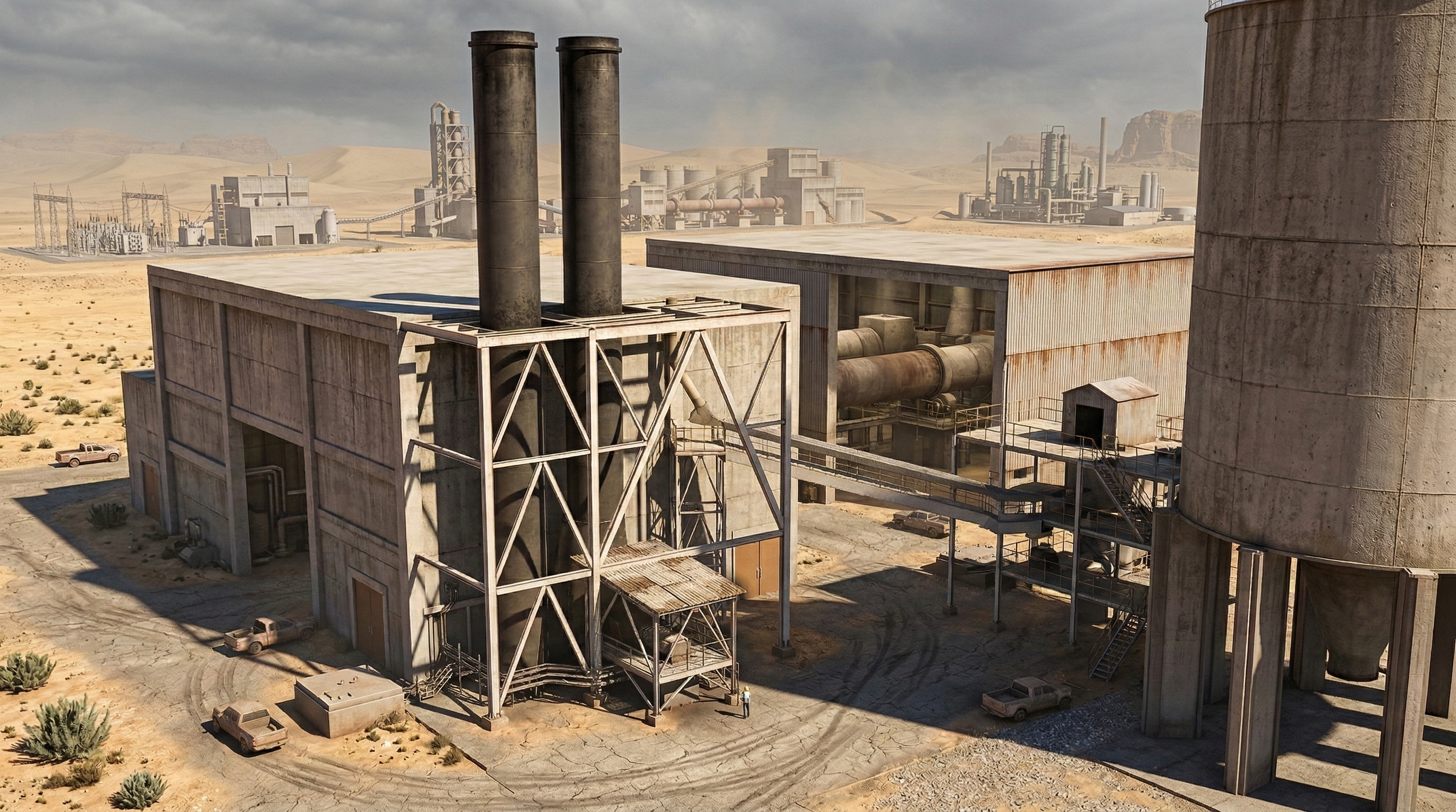
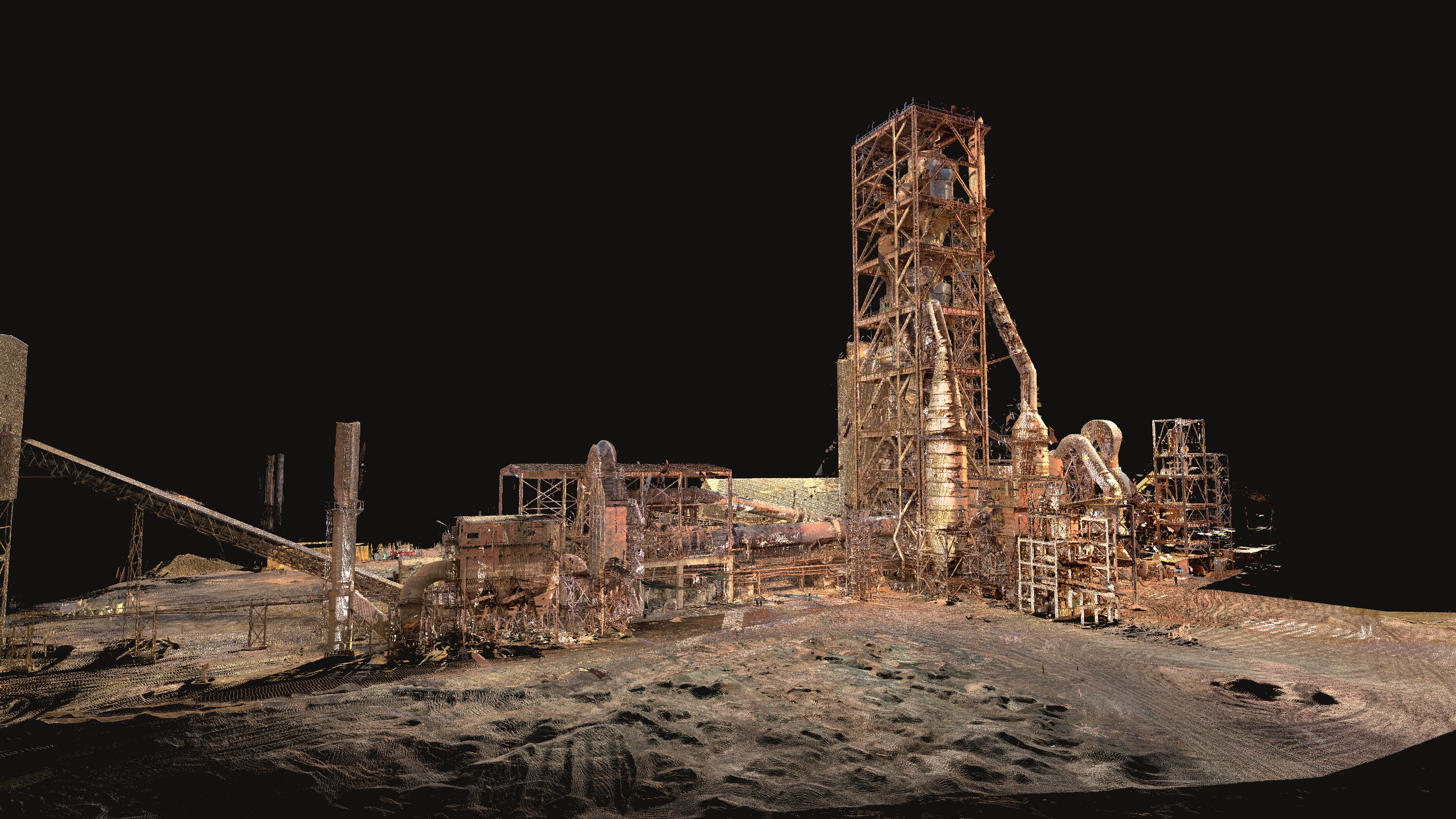
Arabian Cement Factory
Challenge
Massive grinding machinery and dense piping networks create extreme vibrations and "data shadows," hiding critical structural connections and making it impossible to capture clear, stable measurements from a single position.
Solution
We deploy High-Resolution Terrestrial Laser Scanning from multiple elevated platforms. By using vibration-filtering settings and overlapping scan stations, we eliminate noise to capture every pipe and bolt for a complete 3D model.
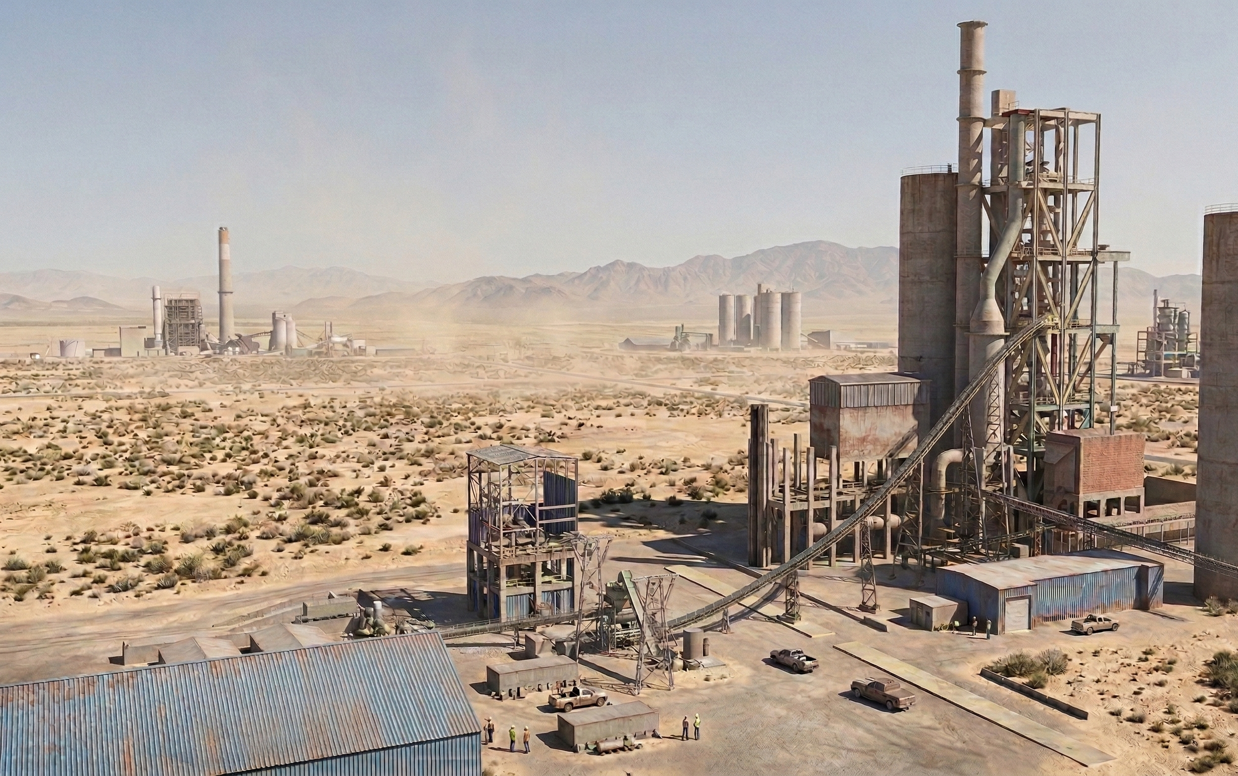
Lafarge Cement Factory
Challenge
The massive height and intricate structural density of the preheater tower make it impossible to capture the high-detail connections required for LOD 400 from the ground, as upper-level steelwork and equipment remain hidden in "data shadows."
Solution
We execute Multi-Level Terrestrial Scanning, placing the scanner on every structural platform from the base to the summit. This overlapping network captures every bolt, plate, and pipe at millimeter precision, providing the high-fidelity data needed for a detailed LOD 400 model.
MBCC Cement Factory
Challenge
Dense scaffolding and constant worker activity during fabrication create massive "data noise" and "occlusions." Static positions are often blocked by temporary poles, while worker movement creates "ghosting" effects that can blur critical structural connections.
Solution
We utilize Terrestrial Laser Scanning (TLS) as the primary tool for millimeter-accurate, supplemented by Handheld Mobile Scanning to reach "blind spots" behind scaffolding. This hybrid approach allows us to filter out site noise and move around obstructions, ensuring a clean, high-precision 3D model of the preheater structure.
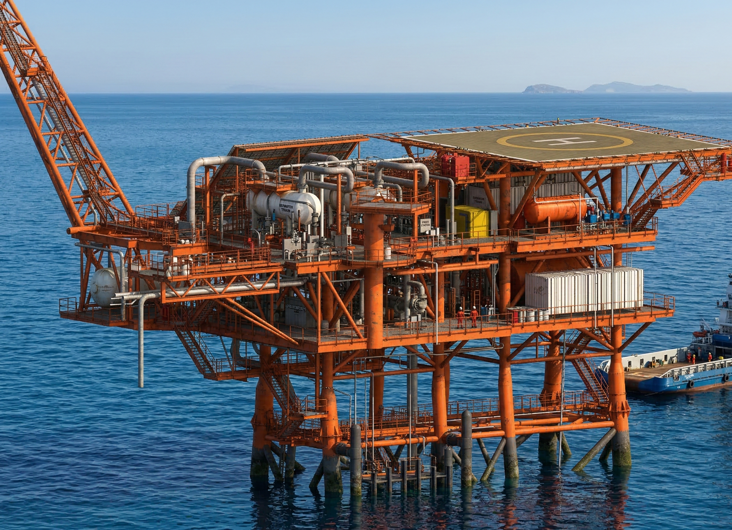
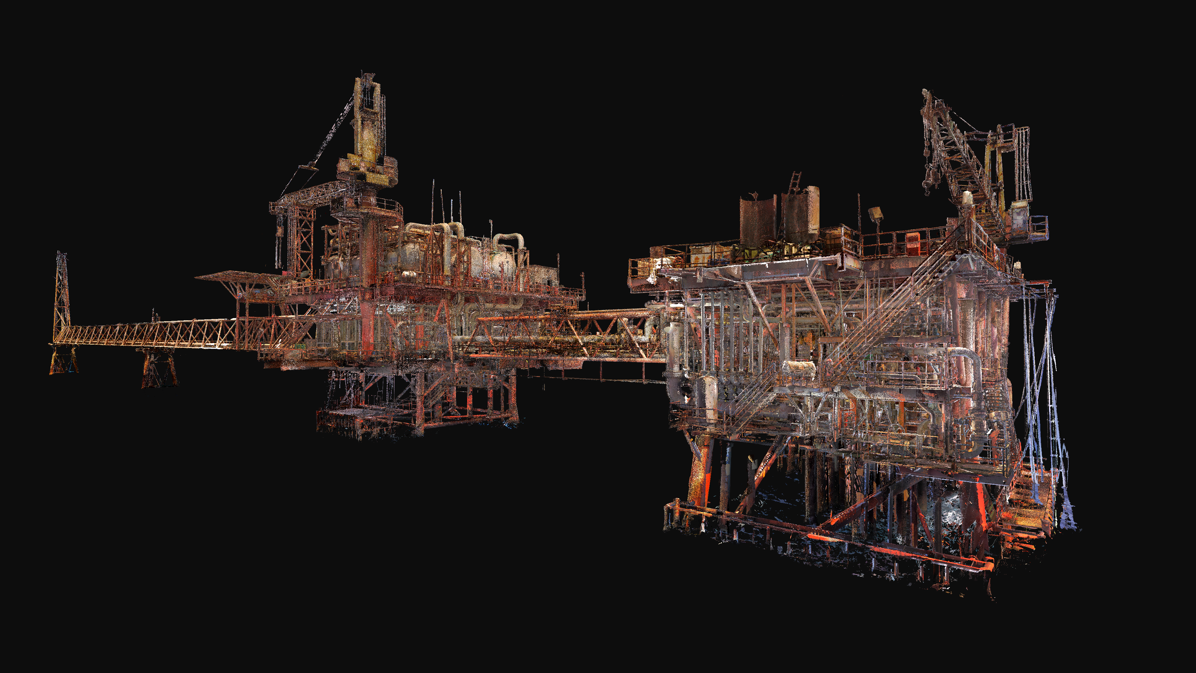
Mediterranean Sea Gas Platforms
Challenge
Offshore platforms are high-vibration, High density of piping systems making it difficult to mount terrestrial scanner and high-risk environments where Salt-Spray Corrosion and reflective stainless-steel piping cause "laser scattering", leading to misaligned structural data.
Solution
We utilize Handheld Mobile Scanning to quickly capture dense piping networks before salt buildup affects the laser. By using a "Multiple Loop" walking path and filtering out high-frequency machinery vibrations in post-processing, we ensure a clean, accurate 3D as-built model for offshore maintenance.
Red Sea Oil Platform
Challenge
Offshore platforms feature extreme reflective surfaces (stainless steel and chrome) and constant structural vibration from heavy drilling equipment, which causes "laser scattering" and distorted, noisy 3D data.
Solution
We utilize High-Resolution Terrestrial Scanning with specialized "Vibration-Filtering" and "Reflective Surface" settings. By establishing a dense network of stable scan stations, we eliminate data noise to provide a clean, millimeter-accurate 3D Pointcloud.
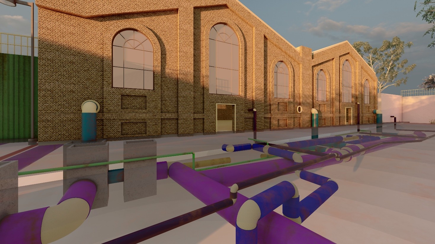
Water Pump Station - Rod El Farag
Challenge
Water stations feature complex, overlapping piping networks both above and underground. Capturing these interconnected systems is difficult because narrow pump rooms and buried infrastructure create "access voids," making it hard to align surface structures with sub-surface utilities.
Solution
We utilize Handheld Mobile Scanning to move fluidly through tight spaces and stairwells in continuous loops. This "Walk-Through" method ensures 100% coverage of complex piping, providing the seamless data needed to build the Integrated Revit Model and detailed 2D AutoCAD infrastructure plans.
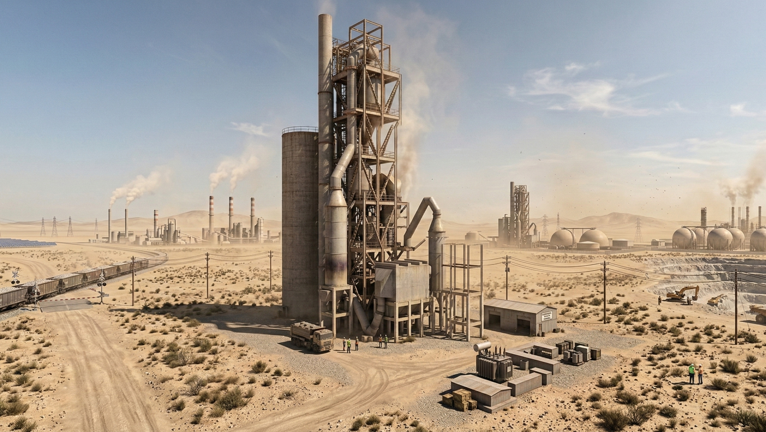
SVCC Cement Factory
Challenge
The extreme heat radiation and atmospheric haze around the kiln and cooler create "mirage effects" that distort laser beams, while the vertical complexity of the preheater causes massive "data shadows" in the structural steel and ducting.
Solution
We utilize High-Resolution Terrestrial Scanning with heat-shielded equipment and "Atmospheric Compensation" settings. By scanning during scheduled maintenance shutdowns and using multi-level stationing, we capture the exact alignment of the kiln and the full structural density of the preheater.
Featured Projects
A selection of our diverse 3D scanning projects across various industries and applications
El Morssi Abo El Abbas Mosque
Kingdom of Saudi Arabia Consulate
Knauf Gypsum Factory
Movenpick
Steel Warehouse
Monorail Station 22
Alexandria Main Post Office
Cotton Bourse Building
Davies and Metropolitan Camp
Horse Racing Grandstands at Sporting Club
Sahuraa Pyramid
College Saint Marc
Abydos Temple of Seti I
Mohammed Ali Castle
Ministry of Finance
East Educational Building
Tanta University Facade
Arabian Cement Factory
Lafarge Cement Factory
MBCC Cement Factory
Mediterranean Sea Gas Platforms
Red Sea Oil Platform
Water Pump Station - Rod El Farag
SVCC Cement Factory
Ready To Start Your Project?
Get in touch to discuss how our expertise can transform your next project.
Contact Us