A jump
into the future
A World Transformed by |
utilizing cutting-edge laser scanning technology and we capture reality in unparalleled detail — enabling smarter design, faster construction, and precise heritage preservation.
We are the architects of precision
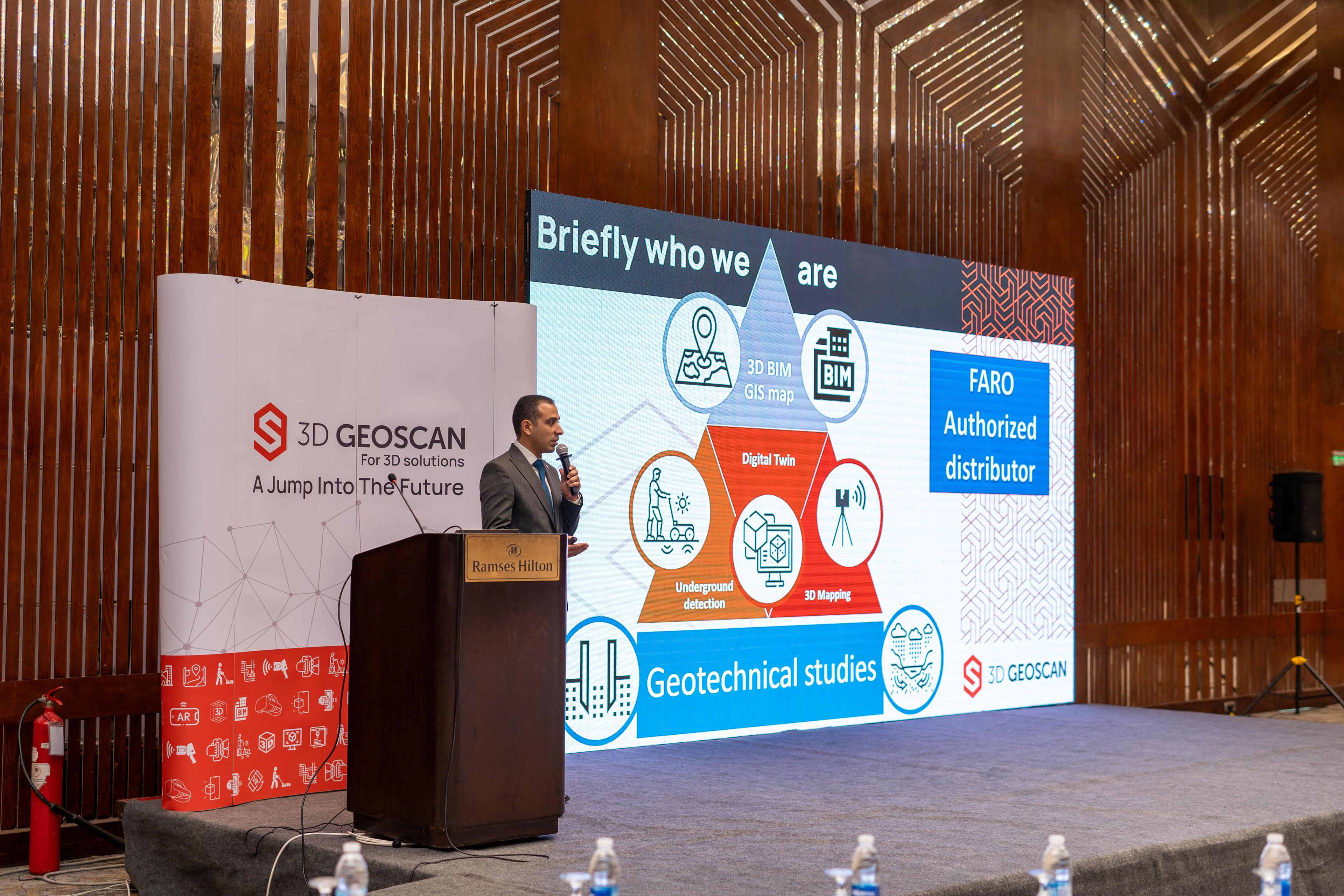
3D Geoscan is an Egyptian company delivering reliable, state-of-the-art 3D geospatial and 3D modeling solutions. We provide full end-to-end services using the latest technologies from trusted, market-leading brands.
What We Do & Why It Matters
Our portfolio of 3D solutions includes (but not limited to) Mobile Data Collection, 3D Scanning, 3D Printing, Ground Penetrating Radar, and Pipeline Mapping.
The result? Higher quality outputs, faster project delivery, and productivity boosts that make timelines shorter and results sharper. Less waiting, more winning.
Industry-Leading Capabilities
With the latest equipment of laser scanners and a team of certified professionals, we deliver unmatched precision and efficiency on every project
Dimensioning a Better World
We map the Earth in 3D to build smarter cities, preserve our past, and protect our future. 3D Geoscan turns geo-intelligence into the ultimate tool for a sustainable planet.
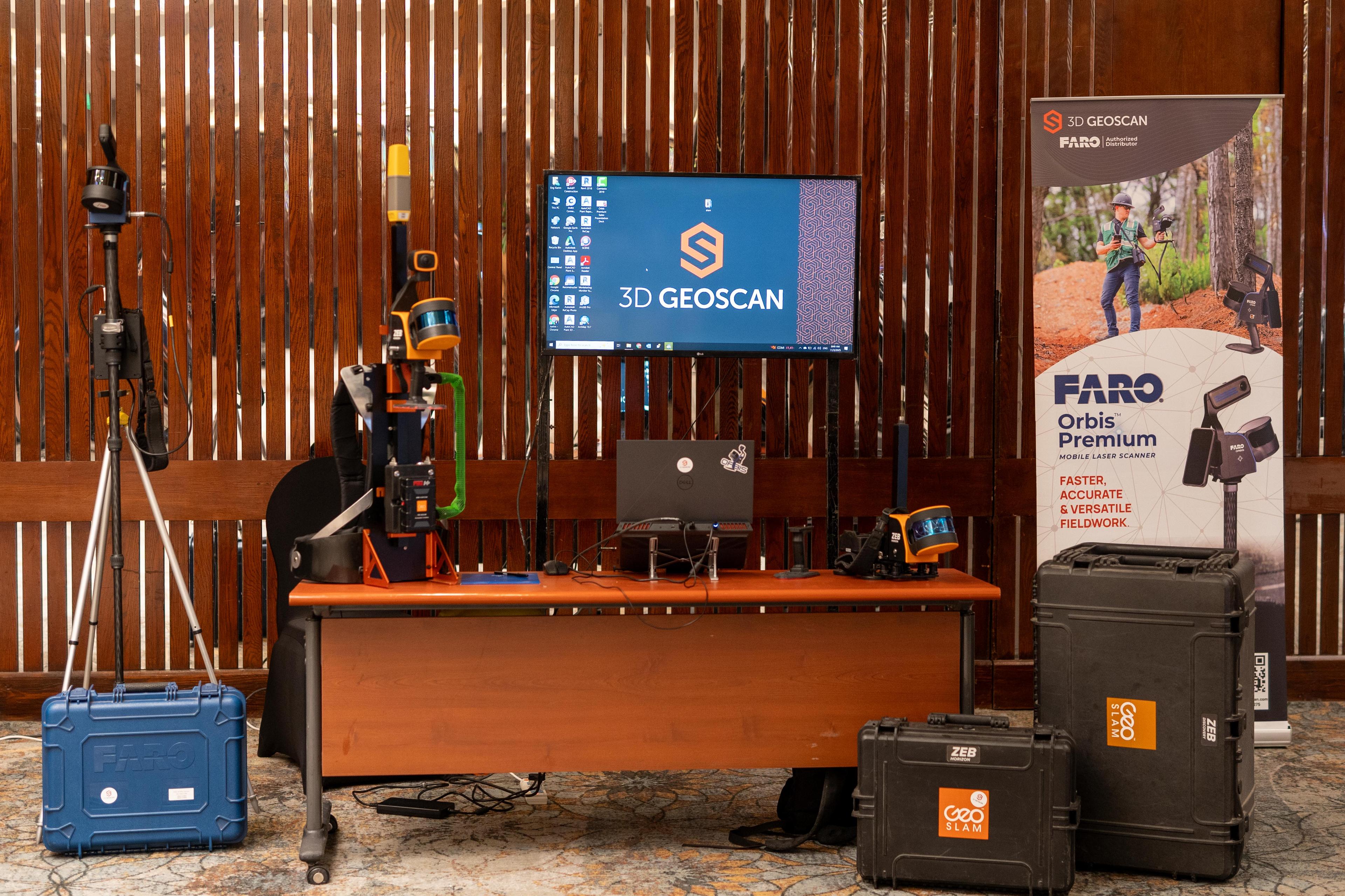
Our Products
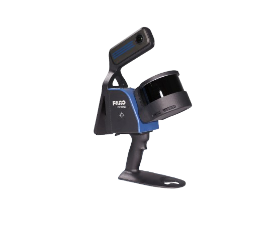
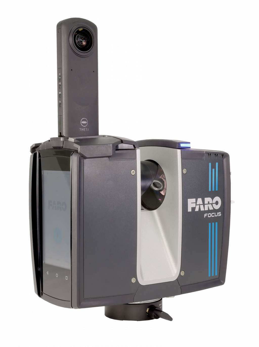
FARO® Orbis™ Premium
FARO Orbis 2 in 1 Mobile Laser Scanner and stationery scanner all in one device. A unique mobile scanning solution created to optimize workflows and elevate productivity. scan while moving with 5 mm accuracy and you can stop for 15 seconds to scan a station with accuracy 2 mm, Designed for construction, engineering and surveying professionals, Orbis delivers rapid speed of capture, while returning highly accurate 3D visual representations of the real world thru 360 camera for point cloud colorization.
Package Includes
- •Scanner
- •Rechargeable Battery
- •Charging Dock
- •Protective Carry Case
Software

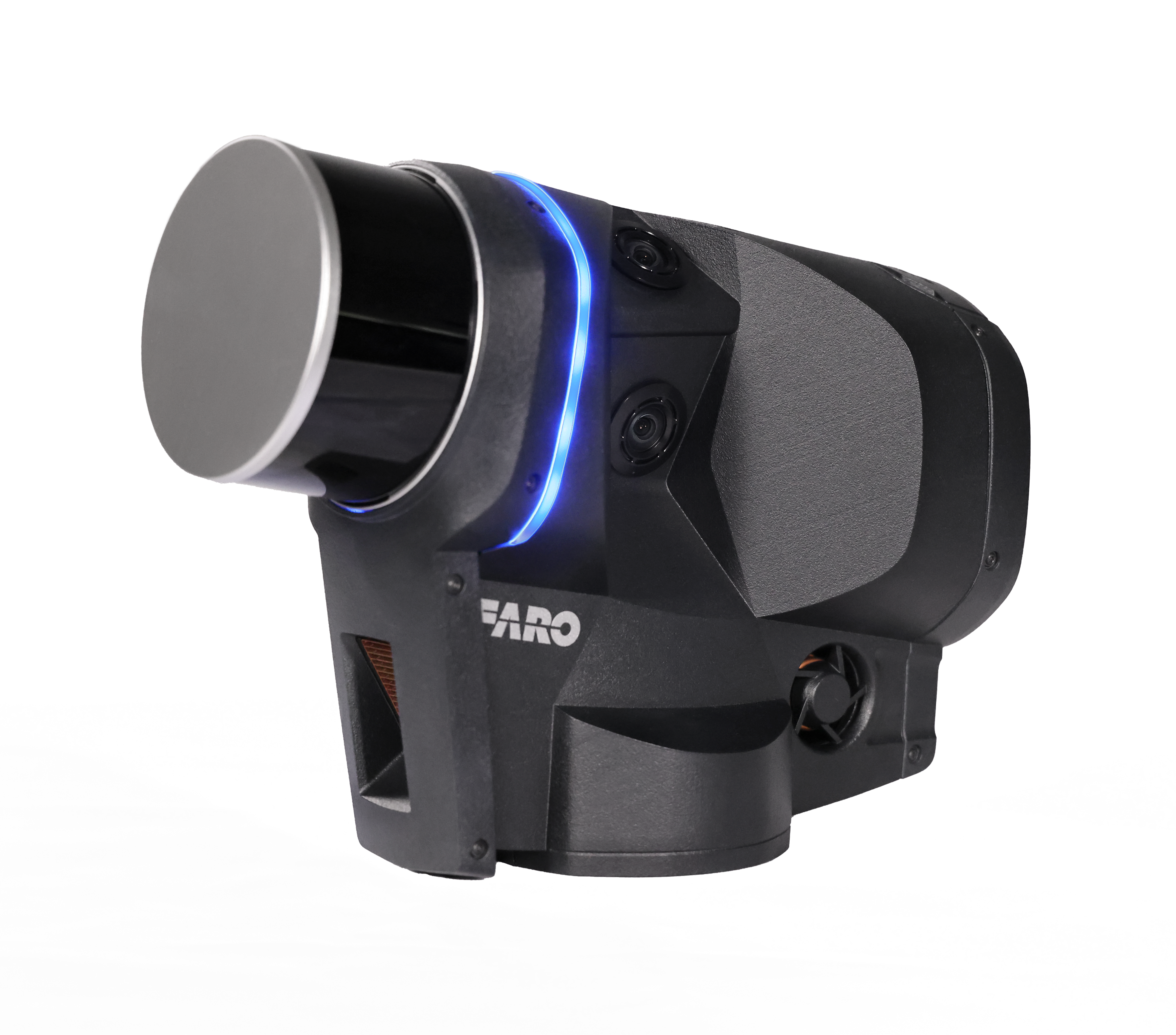
FARO® Focus
Your tool to capture, view and understand the world around you. Great for indoor and outdoor use, including spaces where features are positioned further apart. Lightweight and rugged, simple to use, fast to capture and easy to process giving you the most accurate information you need to make the most important decisions.
Package Includes
- •Scanner
- •Rechargeable Battery
- •Charging Dock
- •Protective Carry Case
Software
FARO® Blink™
From site to insights, Blink is a reality capture solution designed for simplicity and accessibility. It brings high-quality visualization and automated workflows into the hands of designers, builders, surveyors, operators, and public safety professionals, helping teams capture, view, and share data seamlessly, regardless of expertise. With Blink, anyone can take control of reality capture on-site and move projects to final delivery efficiently.
Package Includes
- •Scanner
- •Rechargeable Battery
- •Charging Dock
- •Protective Carry Case
Software
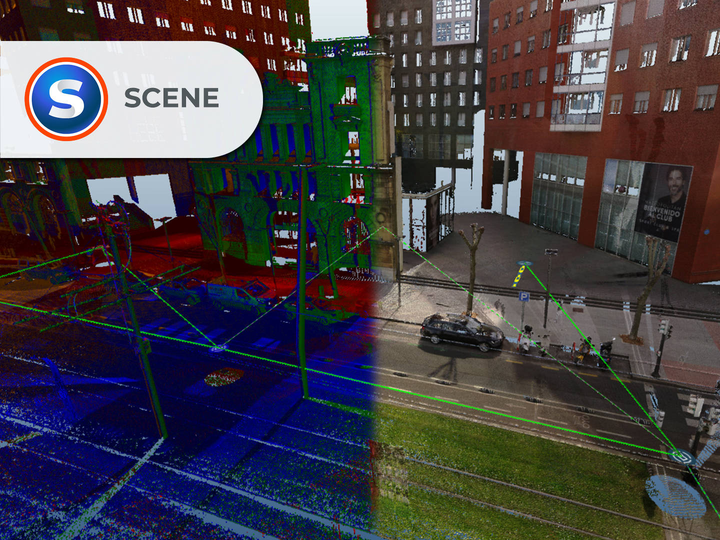
FARO® SCENE Software
SoftwareFARO SCENE software is specifically designed to process and manage scan data from FARO laser scanners. It utilizes automatic object recognition and registration to produce high-quality data. SCENE allows users to combine scans, colorize point clouds, and export data to various formats, featuring an immersive Virtual Reality (VR) view for data evaluation.
Package Includes
- •SCENE Software License
- •VR View Module
- •WebShare Cloud Access
- •Export Utilities
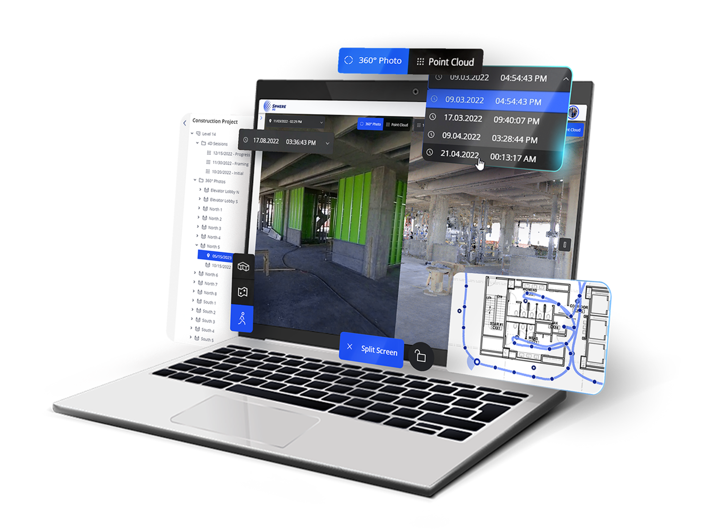
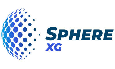
FARO Sphere® XG
SoftwareFARO Sphere XG is a cloud-based digital reality platform that provides a centralized, collaborative experience for reality capture and 3D modeling. When paired with the Stream mobile app, Sphere XG enables faster 3D data capture, processing, and project management from anywhere in the world. It unifies data from stationary scanning, mobile scanning, and 360° photo capture into one environment for 4D progress management.
Package Includes
- •Cloud Platform Access
- •Stream Mobile App Integration
- •Collaborative Workspace
- •Unlimited Cloud Storage
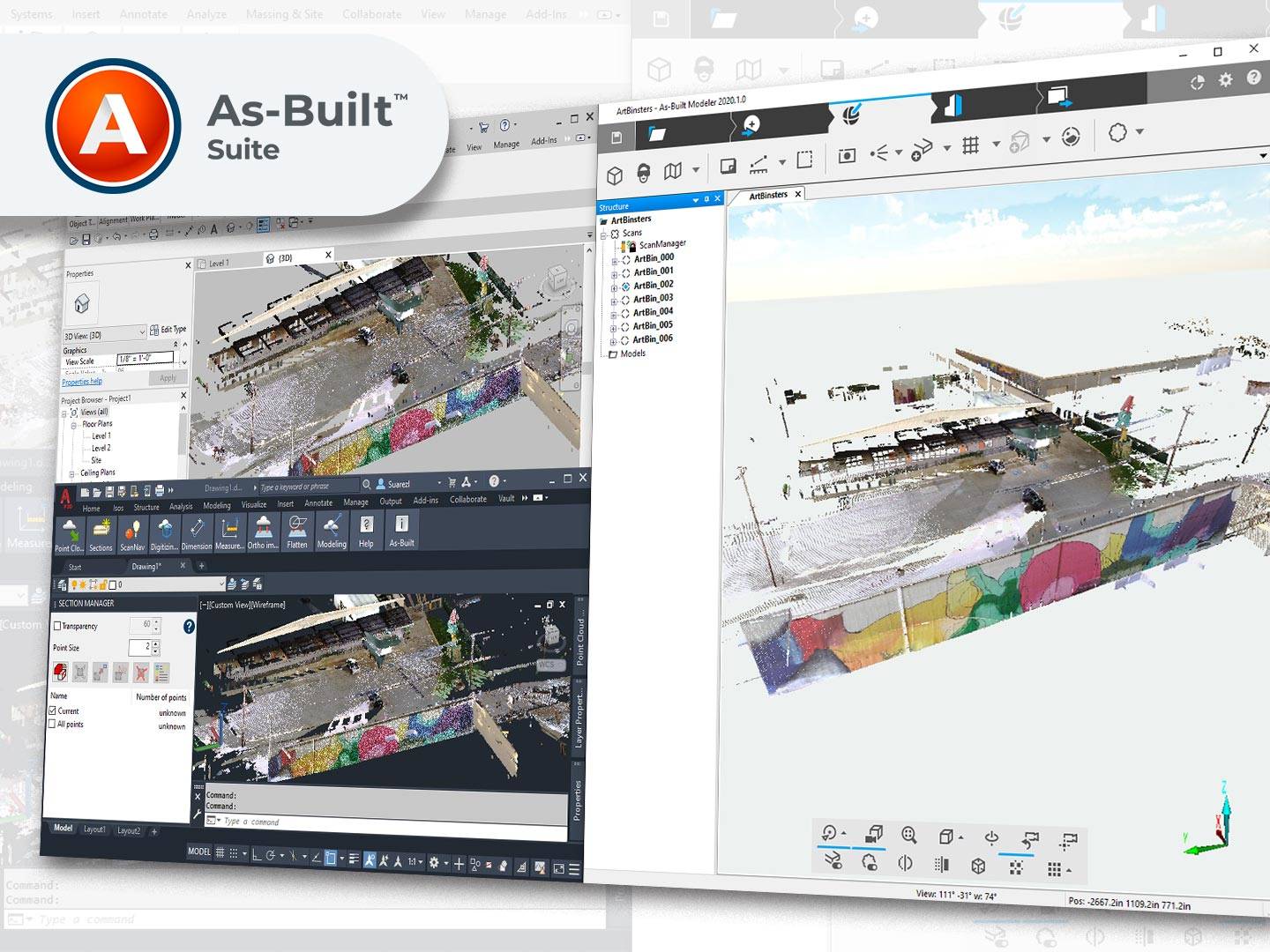
FARO® As-Built™ Software
SoftwareThe FARO As-Built Software Suite specifically enables AEC professionals to process 3D laser scan data directly into Autodesk® AutoCAD® and Revit®. It streamlines the creation of accurate 2D plans and 3D models for BIM integration, reducing the time and effort required to convert reality capture data into deliverable design documents.
Package Includes
- •As-Built for AutoCAD
- •As-Built for Revit
- •As-Built Modeler
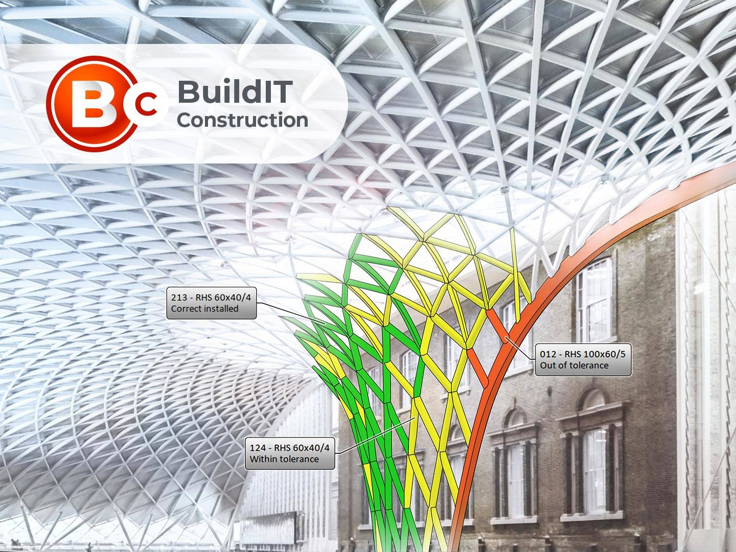
FARO® BuildIT Construction
SoftwareFARO BuildIT Construction is a comprehensive verification software solution that enables laser scan data to be compared against CAD/BIM models in real-time. It is designed to minimize waste and rework by detecting errors early, allowing for accurate floor flatness analysis, tank deformation checks, and prefabrication inspection.
Package Includes
- •BuildIT Construction License
- •Real-time Comparison Tools
- •Analysis Modules
- •Export Utilities
Comprehensive 3D Geospatial Solutions
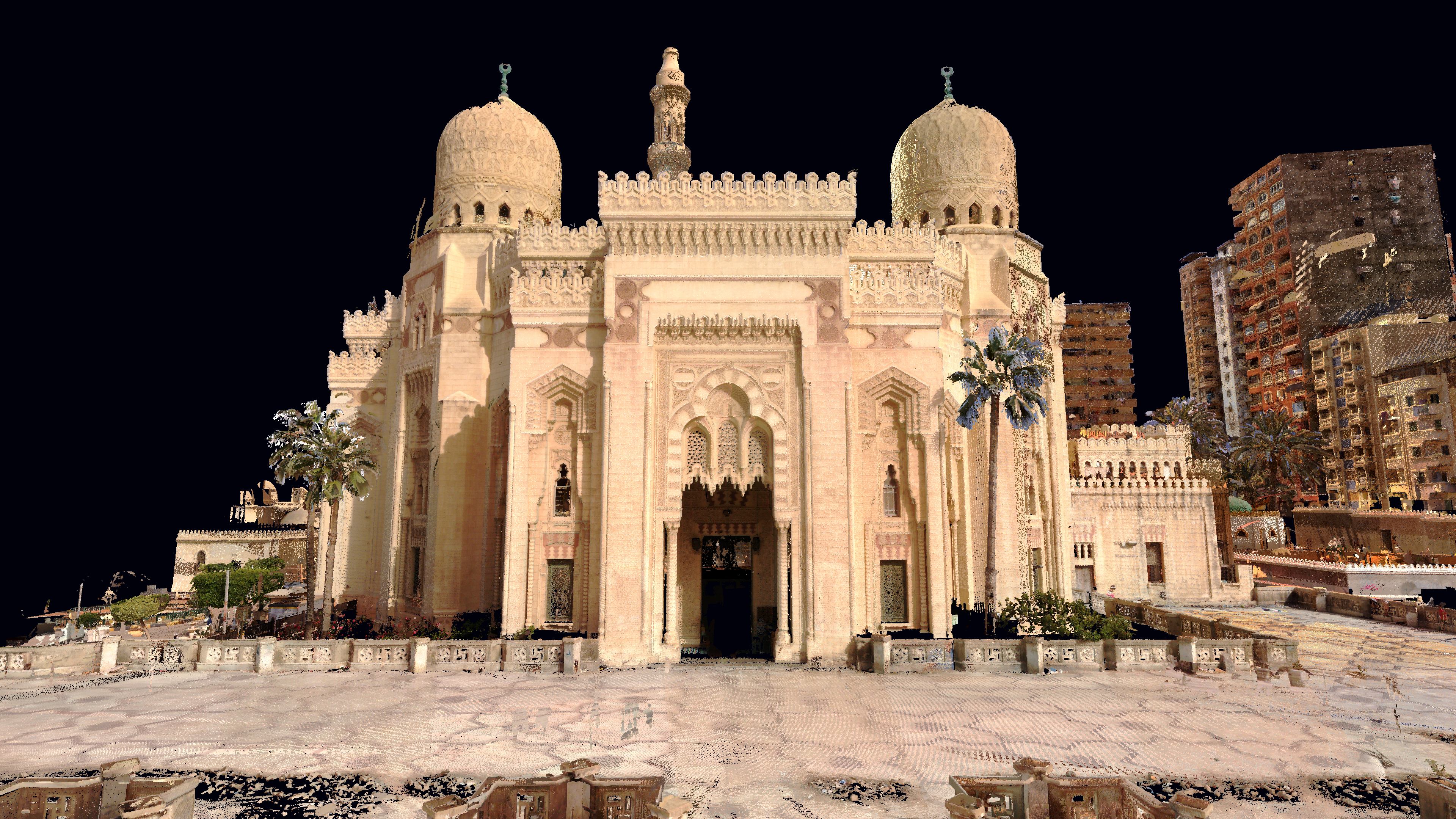
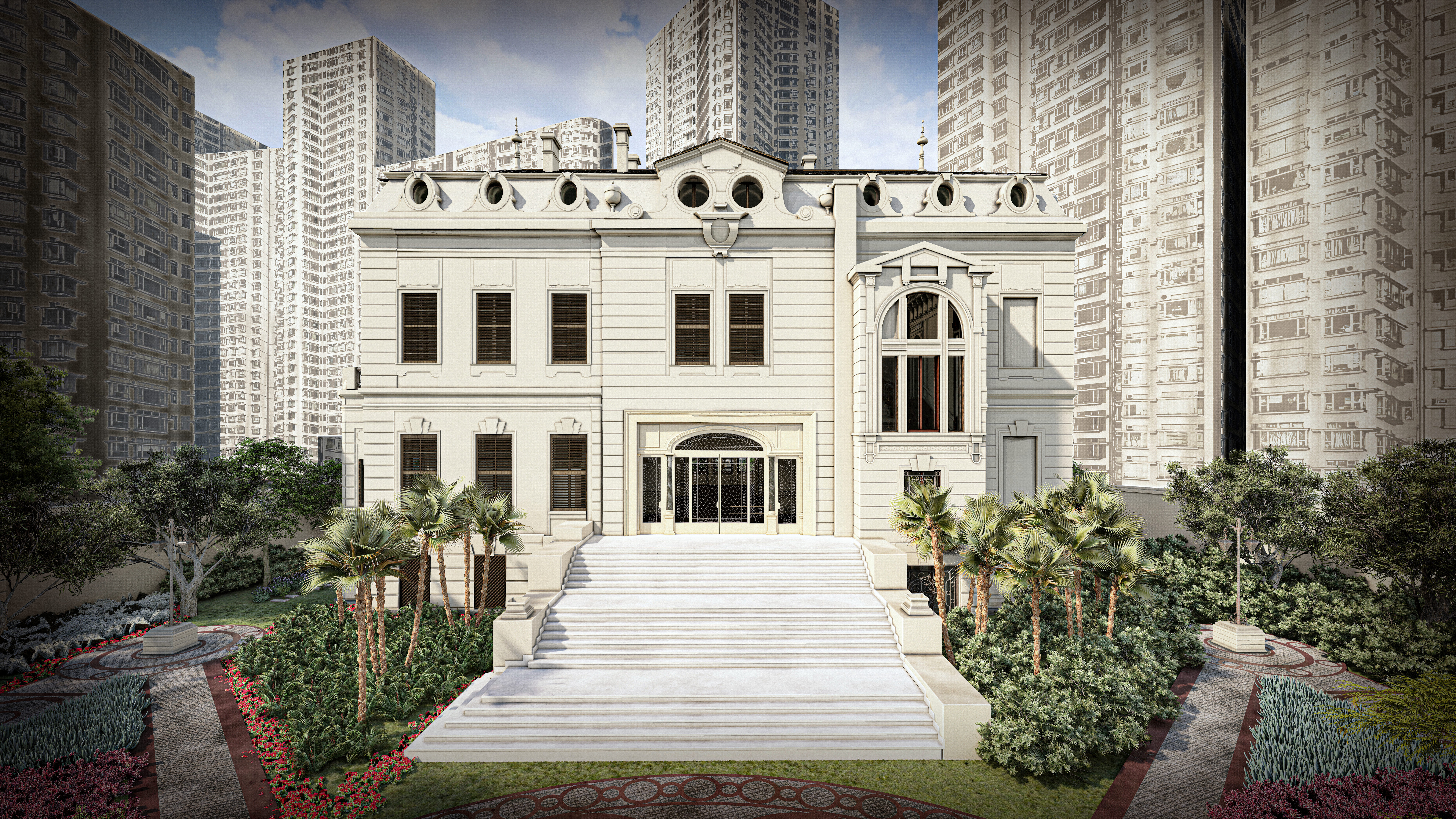
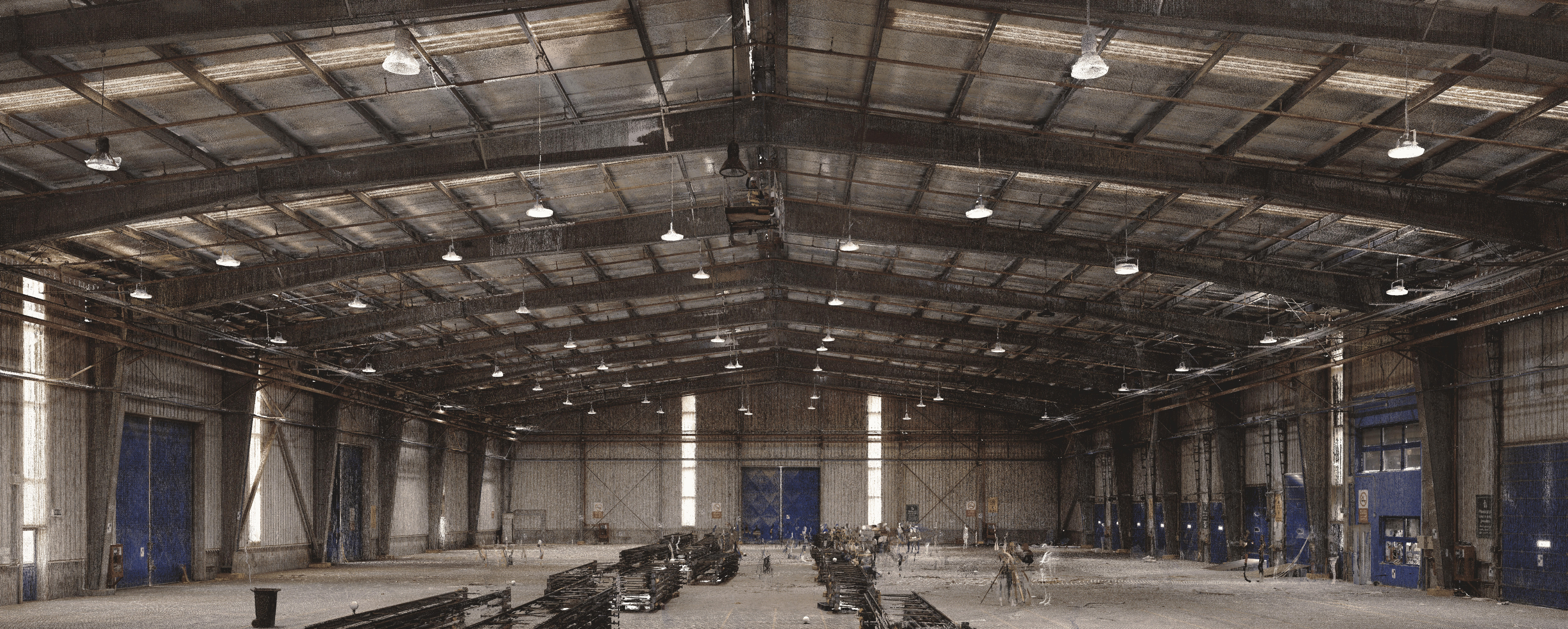
3D Scanning
High-precision laser scanning technology to capture detailed spatial data of structures, terrain, and infrastructure. Create accurate 3D models for documentation, analysis, and planning.
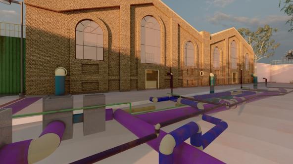
Underground Utilities Mapping
Advanced detection and mapping of underground utilities including pipes, cables, and infrastructure. Prevent costly damages and ensure safe excavation with precise subsurface mapping.
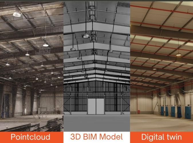
Digital Twin & Facility Management
Create dynamic virtual replicas of physical assets and environments. Enable real-time monitoring, simulation, and predictive maintenance for enhanced decision-making and asset management.
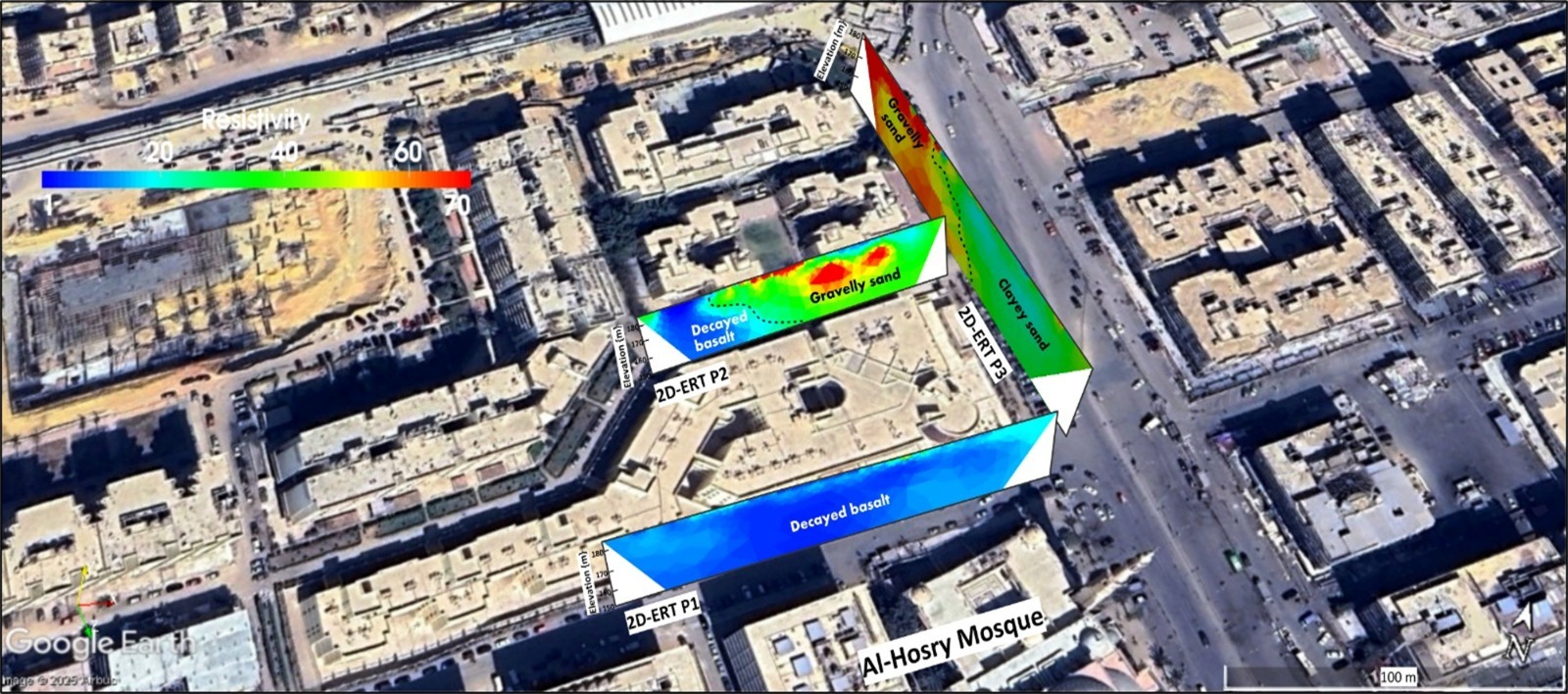
Geophysical Studies
Comprehensive subsurface investigation using advanced geophysical methods. Analyze soil conditions, identify geological features, and assess site characteristics for construction and environmental projects.
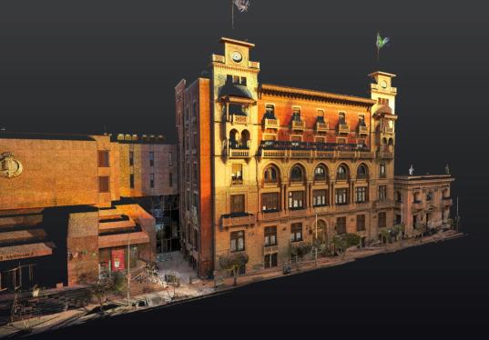
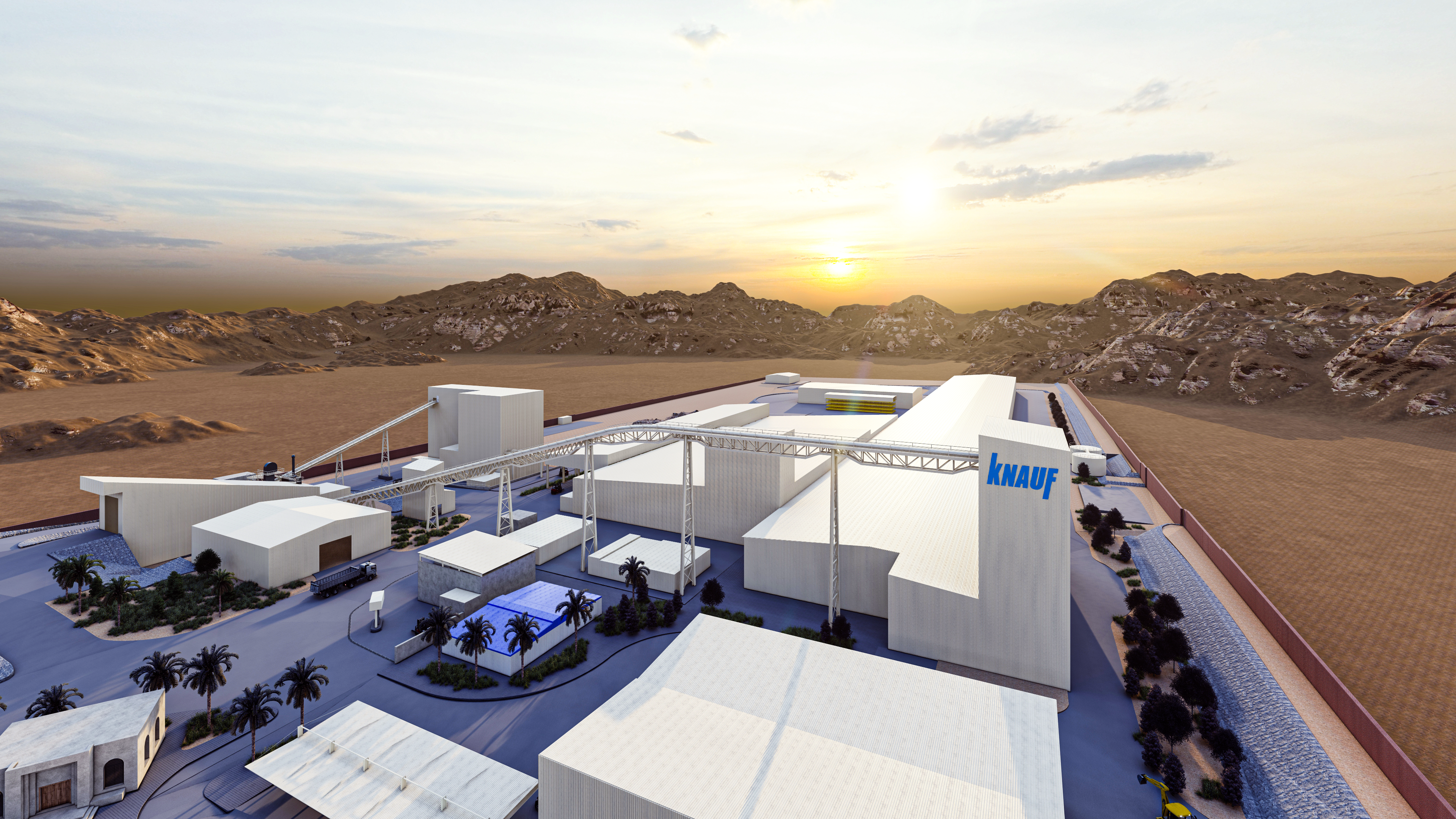
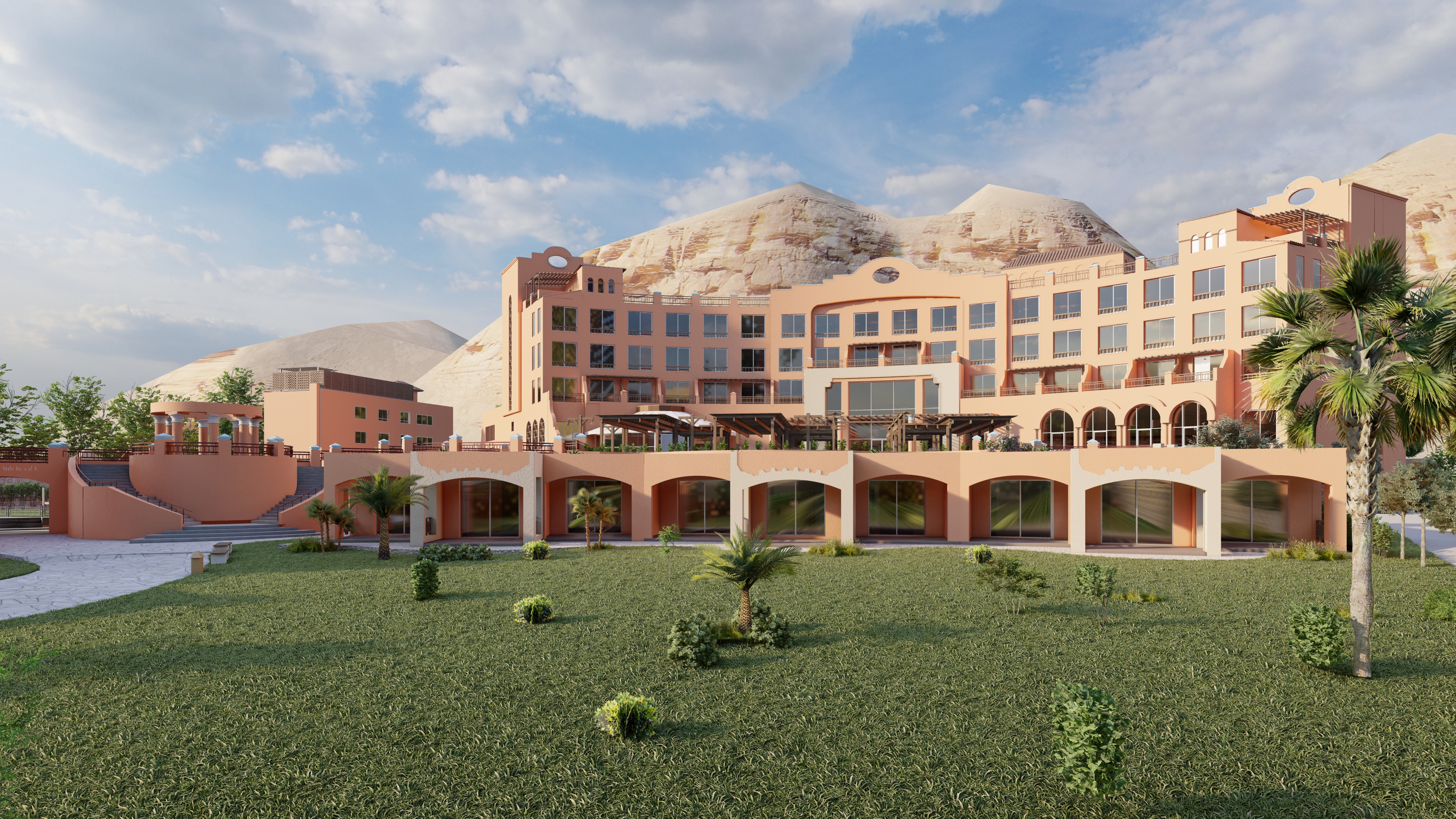
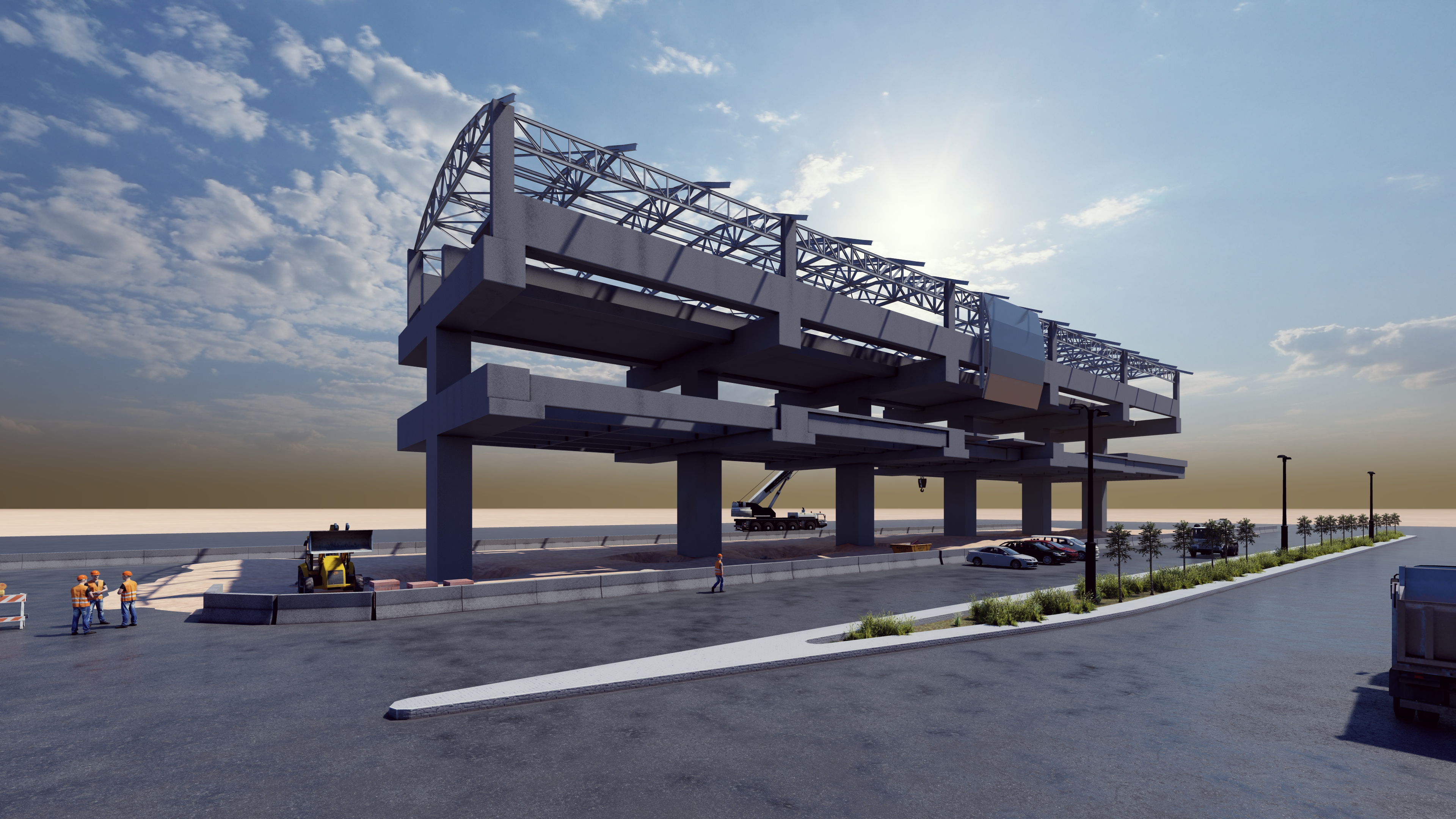
Highlighted Projects
From UNESCO heritage sites to modern industrial complexes, explore our portfolio of precision scanning projects.
Latest from 3D Geoscan
Stay updated with our latest events and activities.
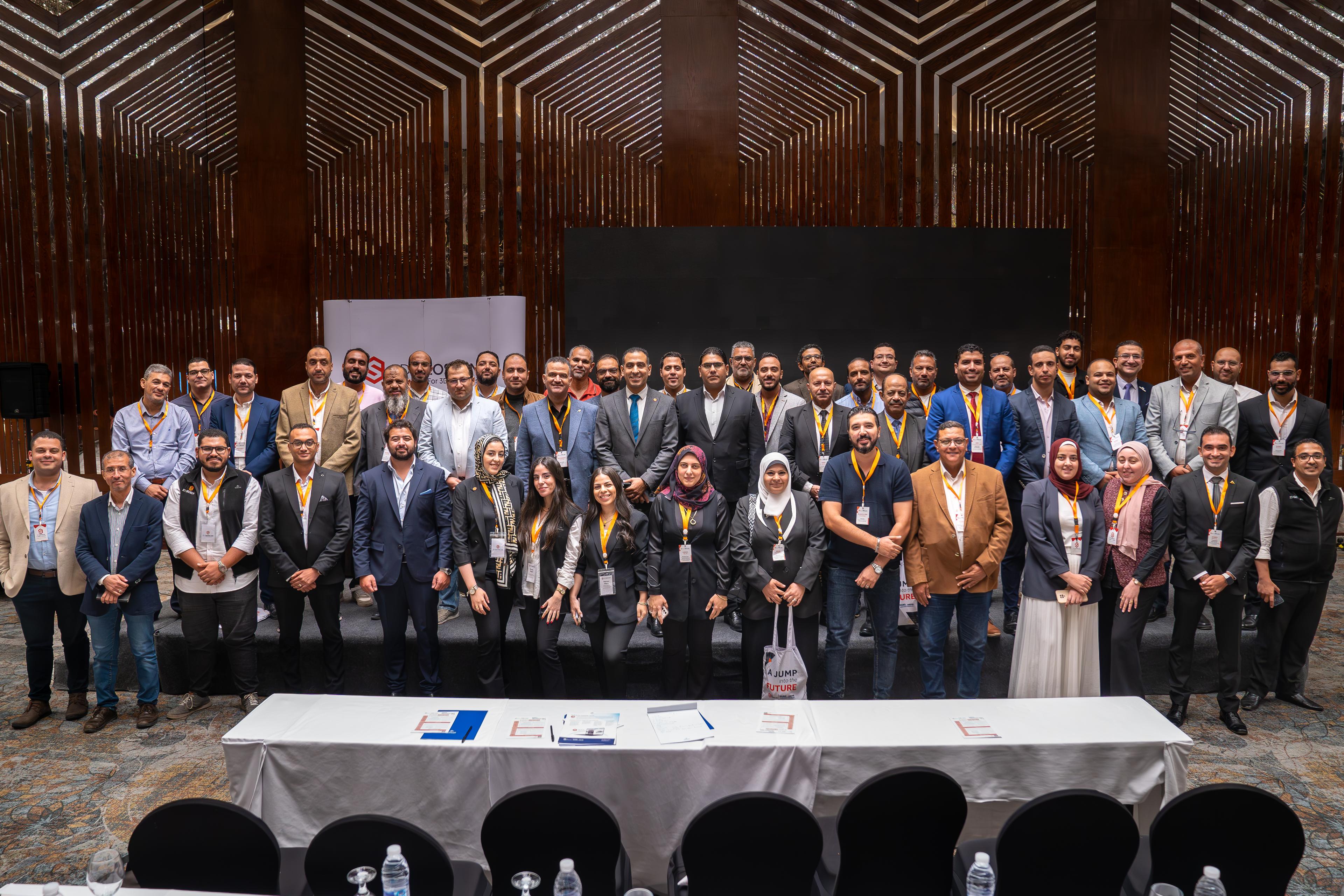
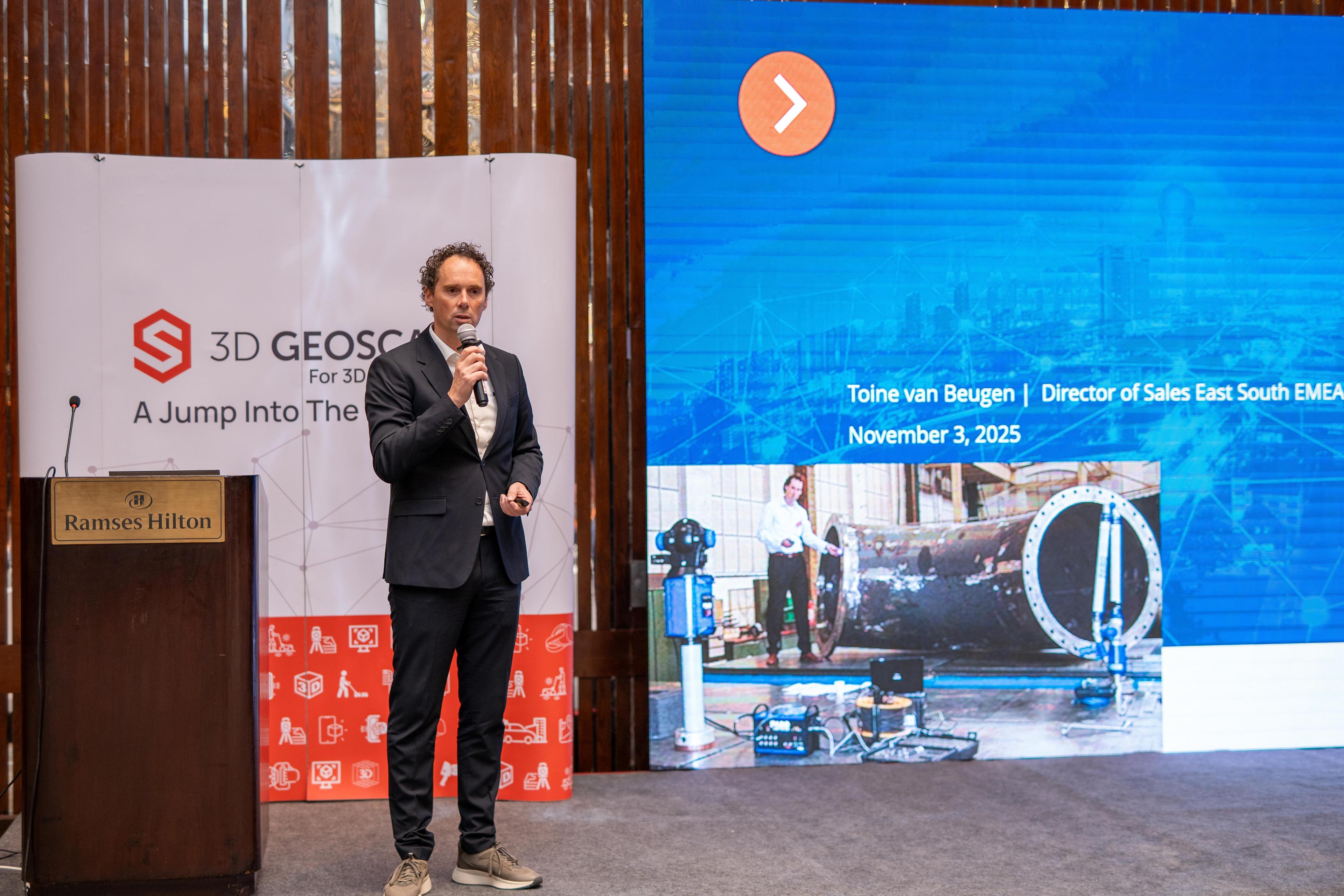
November 14, 2025
FARO Technology Day 2025
3D Geoscan, the authorized distributor of FARO, proudly hosted FARO Technology Day 2025 under the theme “Scan The Future.” The event brought together industry professionals to explore the latest FARO technologies through live demonstrations, real-world project case studies from Egypt, and hands-on experience with cutting-edge FARO devices—showcasing how advanced 3D scanning is shaping the future of measurement and digital reality